Winterhaven in Imperial County, California — The American West (Pacific Coastal)
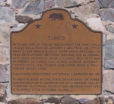
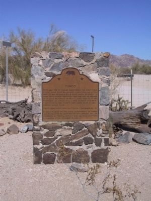
Tumco
Erected 1985 by State Department of Parks and Recreation in cooperation with Imperial Valley Pioneers Historical Society and Squibob Chapter, E Clampus Vitys. (Marker Number 182.)
Topics and series. This historical marker is listed in these topic lists: Industry & Commerce • Settlements & Settlers. In addition, it is included in the California Historical Landmarks, and the E Clampus Vitus series lists. A significant historical month for this entry is January 1848.
Location. 32° 52.909′ N, 114° 51.728′ W. Marker is in Winterhaven, California, in Imperial County. Marker is at the intersection of Gold Rock Ranch Road and Walker Way on Gold Rock Ranch Road. Marker is located at Gold Rock Ranch. Touch for map. Marker is at or near this postal address: 2401 Gold Rock Ranch Road, Winterhaven CA 92283, United States of America. Touch for directions.
Other nearby markers. At least 8 other markers are within 15 miles of this marker, measured as the crow flies. Obregon (approx. 4.6 miles away); The Island of California (approx. 10.7 miles away); Site of Camp Pilot Knob (approx. 11 miles away); The Plank Road (approx. 12.4 miles away); a different marker also named Plank Road (approx. 12.4 miles away); a different marker also named Plank Road (approx. 12.4 miles away); Hernando De Alarcon Expedition - 1540 (approx. 13.1 miles away); Mormon Battalion Crossing / Colorado River Crossing (approx. 14.3 miles away in Arizona). Touch for a list and map of all markers in Winterhaven.
Credits. This page was last revised on July 9, 2016. It was originally submitted on December 17, 2011, by Michael Kindig of Elk Grove, California. This page has been viewed 859 times since then and 43 times this year. Photos: 1, 2, 3. submitted on December 17, 2011, by Michael Kindig of Elk Grove, California. • Syd Whittle was the editor who published this page.


