Downtown Las Vegas in Clark County, Nevada — The American Mountains (Southwest)
Westside School
1923
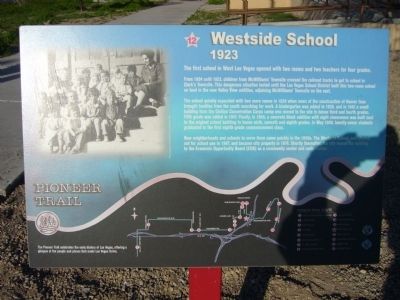
The first school in West Las Vegas opened with two rooms and two teachers for four grades.
From 1904 until 1923, children from McWilliams' Townsite crossed the railroad tracks to get to school in Clark's Townsite. This dangerous situation lasted until the Las Vegas School District built this two-room school on land in the new Valley View addition, adjoining McWilliams' Townsite on the east.
The school quickly expanded with two more rooms in 1928 when news of the construction of Hoover Dam brought families from the south searching for work. A kindergarten was added in 1938, and in 1942 a small building from the Civilian Conservation Corps camp was moved to the site to house third and fourth grades. Fifth grade was added in 1947. Finally, in 1948, a concrete block addition with eight classrooms was built next to the original school building to house sixth, seventh and eight grades. In May 1949, twenty-seven students graduated in the first eight grade commencement class.
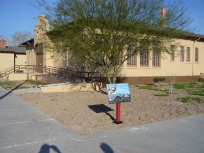
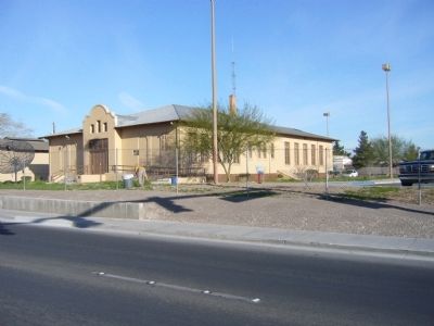
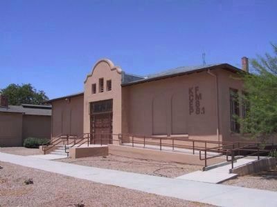
New neighborhoods and schools to serve them came quickly in the 1950s. The Westside School, was phased out for school use in 1967, and became city property in 1974. Shortly thereafter, the city leased the building to the Economic Opportunity Board (EOB) as a community center and radio station.
Erected by the City of Las Vegas, Clark County, Preserve America & the Southern Nevada Public Lands Management Act. (Marker Number 12.)
Topics and series. This historical marker is listed in these topic lists: Education • Notable Buildings. In addition, it is included in the Civilian Conservation Corps (CCC) series list. A significant historical month for this entry is May 1949.
Location. 36° 10.869′ N, 115° 8.766′ W. Marker is in Las Vegas, Nevada, in Clark County. It is in Downtown Las Vegas. Marker can be reached from C Street south of Jefferson Avenue. Marker is in parking lot accessed from C Street. Touch for map. Marker is at or near this postal address: 330 West Washington Avenue, Las Vegas NV 89106, United States of America. Touch for directions.
Other nearby markers. At least 8 other markers are within walking distance of this marker. Harrison Boarding House (approx. 0.2 miles away); St. James the Apostle (approx. 0.3 miles away); McWilliams' Townsite (approx. 0.3 miles away); Jackson Street Commercial District (approx. 0.4 miles away); Moody House (approx. 0.4 miles away); Christensen House "The Castle" (approx. 0.4 miles away); Las Vegas Paiute Colony (approx. half a mile away); Moulin Rouge (approx. half a mile away). Touch for a list and map of all markers in Las Vegas.
More about this marker. This site is #12 on the Pioneer Trail Route. Noted on marker: The Pioneer Trail celebrates the early history of Las Vegas, offering a glimpse of the people and places that made Las Vegas thrive.
Related markers. Click here for a list of markers that are related to this marker. The Pioneer Trail - West Las Vegas
Also see . . . Westside School page for the www.LasVegsaPioneerTrail.com website. Visit the www.LasVegasPioneerTrail.com to learn more about the Westside School (Submitted on October 31, 2020, by Deuce Brandt of North Las Vegas, Nevada.)
Credits. This page was last revised on February 7, 2023. It was originally submitted on March 28, 2010, by Bill Kirchner of Tucson, Arizona. This page has been viewed 1,347 times since then and 16 times this year. Last updated on December 28, 2011, by Michael Kindig of Elk Grove, California. Photos: 1, 2, 3. submitted on March 28, 2010, by Bill Kirchner of Tucson, Arizona. 4. submitted on December 8, 2011, by Michael Kindig of Elk Grove, California. • Syd Whittle was the editor who published this page.


