Rimini in Clarendon County, South Carolina — The American South (South Atlantic)
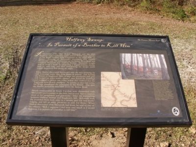
Halfway Swamp:
“… In pursuit of a Brother to Kill Him”
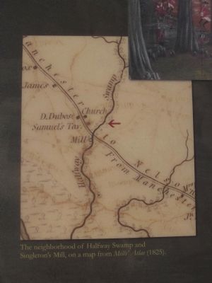
When Marion discovered McLeroth’s trick the next morning, he sent horsemen under Maj. John James in pursuit. Just beating the British to Singleton’s Mill—a large rice plantation and grist mill located ten miles north—James’s men seized the buildings and managed to deliver one volley before they realized that the Singletons were ill with smallpox. As quickly as they had come, the Whigs abandoned the plantation to the British. The next day Marion moved his men back down the Santee Road.
British commanders in South Carolina were dissatisfied with McLeroth’s performance in the field, but several Patriot sources attest to his uprightness and generosity. After the skirmishing between Halfway Swamp and Singleton’s Mill, McLeroth took the wounded from both sides to a tavern, paid for two weeks’ lodging, and left an army physician to care for them. When Marion discovered what McLeroth had done, he said to one of his officers: “Well, I suppose I feel now very much as I would feel were I in pursuit of a brother to kill him.”
Erected 2012 by Francis Marion Trail Commission of Francis Marion University.
Topics and series. This historical marker is listed in these topic lists: Patriots & Patriotism • War, US Revolutionary. In addition, it is included in the Francis Marion Trail series list. A significant historical month for this entry is December 1781.
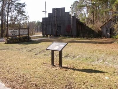
Location. 33° 39.083′ N, 80° 29.774′ W. Marker is in Rimini, South Carolina, in Clarendon County. Marker is at the intersection of Old River Road and Elliots Landing Road, on the right when traveling south on Old River Road. Touch for map. Marker is in this post office area: Pinewood SC 29125, United States of America. Touch for directions.
Other nearby markers. At least 8 other markers are within 7 miles of this marker, measured as the crow flies. Encounter at Halfway Swamp / Site of Original St. Mark's Church (approx. Ľ mile away); Richardson Graves (approx. one mile away); Col. David Dubose Gaillard (approx. 5.3 miles away); Good Hope Picnic (approx. 5.7 miles away); Pine Grove Evangelical Lutheran Church (approx. 6.1 miles away); Andrews Chapel Church (approx. 6.4 miles away); St. Mark's Episcopal Church (approx. 6.7 miles away); Richard Richardson (approx. 6.7 miles away). Touch for a list and map of all markers in Rimini.
More about this marker. The date on the marker should be December 1780 and not 1781.
Related markers. Click here for a list of markers that are related to this marker. To better understand the relationship, study each marker shown.
Photographed By Anna Inbody, January 8, 2012
3. Photo on Halfway Swamp Marker
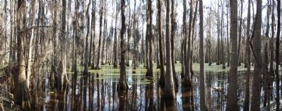
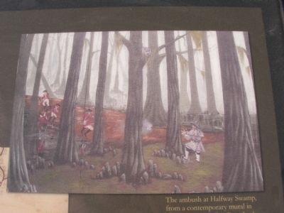
The ambush at Halfway Swamp, from a contemporary mural in Manning, South Carolina. In the story of the Revolutionary War in South Carolina, the natural environment is an important character. Francis Marion’s men, intimately familiar with the Lowcountry’s rivers, swamps, and forests, often used them to their tactical advantage. Like many sites associated with Marion, Halfway Swamp is both an ecological and a historical treasure. Courtesy Swamp Fox Mural Trail Society.
Photographed By Anna Inbody, January 8, 2012
7. Ambush at Half-way Swamp Marker
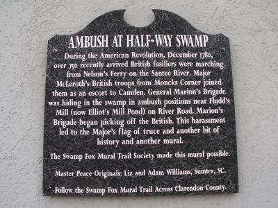
During the American Revolution, December 1780, over 750 recently arrived British fusiliers were marching from Nelson's Ferry on the Santee River. Major McLeroth's British troops from Moncks Corner joined them as an escort to Camden. General Marion's Brigade was hiding in the swamp in ambush positions near Fludd's Mill (now Elliot's Mill Pond) on River Road. Marion's Brigade began picking off the British. This harassment led to the Major's flag of truce and another bit of history and another mural.
The Swamp Fox Mural Trail Society made this mural possible.
Master Peace Originals: Liz and Adam Williams, Sumter, SC.
Follow the Swamp Fox Mural Trail Across Clarendon County.
The Swamp Fox Mural Trail Society made this mural possible.
Master Peace Originals: Liz and Adam Williams, Sumter, SC.
Follow the Swamp Fox Mural Trail Across Clarendon County.
Credits. This page was last revised on July 8, 2023. It was originally submitted on January 9, 2012, by Anna Inbody of Columbia, South Carolina. This page has been viewed 2,383 times since then and 85 times this year. Last updated on July 6, 2023, by C Summers of Manning, South Carolina. Photos: 1, 2, 3, 4, 5, 6, 7. submitted on January 9, 2012, by Anna Inbody of Columbia, South Carolina. • Bernard Fisher was the editor who published this page.
