Black Hawk in Gilpin County, Colorado — The American Mountains (Southwest)
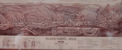
Bird’s-eye view of Black Hawk
Gilpin County, Colorado
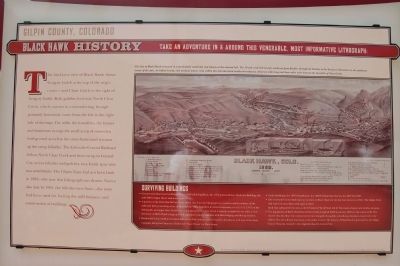
Black Hawk History
Take an adventure in & around this venerable, most informative lithograph:
This bird’s-eye view of Black Hawk shows Gregory Gulch at the top of the map’s center – and Chase Gulch to the right of Gregory Gulch. Both gulches feed into North Clear Creek, which courses in a meandering, through primarily horizontal, route from the left to the right side of the map. The mills, the foundries, the homes and businesses occupy the small areas of somewhat level ground as well as the stone-buttressed terraces up the steep hillsides. The Colorado Central Railroad follows North Clear Creek and then on up to Central City, across hillsides and gulches, in a 4-mile spur with two switchbacks. The Gilpin Tram had not been built in 1882 – the year that this lithograph was drawn. Notice also that by 1882, the hillsides were bare –the trees had been used for fueling the mill furnaces and construction of buildings.
Surviving Buildings
• Commercial/dowtown buildings: the ca. 1860’s Rohling Block, the 1875 Jenkins-McKay Hardware Building, the mid-1880’s Gilpin Hotel, and many more;
• A portion of the Polar Star Mine in Chase Gulch (no. 4 on the lithograph) is a survivor and is evidence of the mills and their processing of ore in Black Hawk. Mill, foundries & related
• Residential homes built in the latter half of the 19th century may be found in abundance with one of the finest examples being the Carpenter Gothic-style ‘Lace House’ on Main Street.
• Public Buildings: the 1870 Schoolhouse, the 1863 Presbyterian Church, the 1877 City Hall;
• The Colorado Central Railroad ran its trains to Black Hawk for the last time in the year 1941. The Gilpin Tram had ended its near 40-year life span in 1917.
Both vital railways left the area as the US entered World Wars I & II. The tracks, depots, and trestles are now gone.
• The population of Black Hawk has declined from a high of 2,000 in the late 1880’s to the current 140. The church that sits above the commercial center alongside the public schoolhouse has been converted to city offices. The schoolhouse functions as the police station. The history of Black Hawk is presented at the Gilpin County Museum, housed in the original school in Central City.
Topics. This historical marker is listed in this topic list: Settlements & Settlers. A significant historical year for this entry is 1882.
Location. 39° 48.105′ N,

Photographed By Barry Swackhamer, July 1, 2009
2. Detail from the Bird’s-eye view of Black Hawk Marker
[Caption above the lithograph:]
The City of Black Hawk is located in a particularly metal-rich zone known as the mineral belt. The 50-mile wide belt extends southwest from Boulder through the Rockies to the San Juan Mountains in the southwest corner of the state. In Gilpin County, rich oxidized quartz veins within this belt also tend northeast-southwest, about six miles long and three miles wide between the two forks of Clear Creek.
Other nearby markers. At least 8 other markers are within one mile of this marker, measured as the crow flies. Fick’s Carriage Shop (a few steps from this marker); Gilpin Hotel (within shouting distance of this marker); Train Trestle (about 300 feet away, measured in a direct line); Colorado Central Railroad (approx. half a mile away); Central City Opera (approx. one mile away); Central City (approx. one mile away); The Rose Haydee Building (approx. one mile away); The Ignatz Meyer Building (approx. one mile away). Touch for a list and map of all markers in Black Hawk.
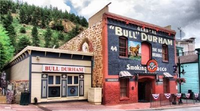
More about this marker. This marker is located to the left of the Bull Durham Saloon & Casino.
Also see . . .
1. Black Hawk, Colorado: History and Fun Facts. (Submitted on January 22, 2012, by Barry Swackhamer of Brentwood, California.)
2. Black Hawk, Colorado - Wikipedia. (Submitted on January 22, 2012, by Barry Swackhamer of Brentwood, California.)
Additional keywords. lithograph, bird's-eye view
Credits. This page was last revised on June 16, 2016. It was originally submitted on January 22, 2012, by Barry Swackhamer of Brentwood, California. This page has been viewed 1,127 times since then and 18 times this year. Photos: 1, 2, 3. submitted on January 22, 2012, by Barry Swackhamer of Brentwood, California. • Bill Pfingsten was the editor who published this page.

