Marker Logo HMdb.org THE HISTORICAL
MARKER DATABASE
“Bite-Size Bits of Local, National, and Global History”
Bakersfield in Kern County, California — The American West (Pacific Coastal)
 

Kern County Land Company Building


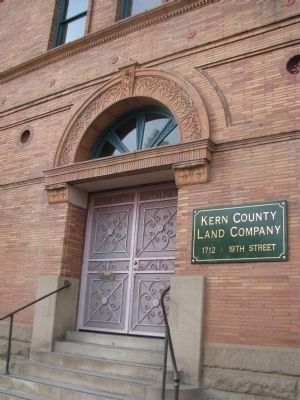
Kern County Land Company Building Marker image. Click for full size.
Photographed By Denise Boose, February 12, 2012
1. Kern County Land Company Building Marker
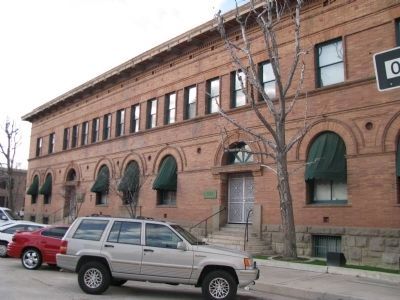
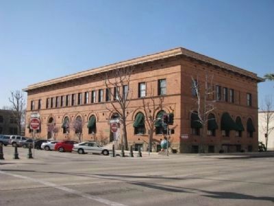
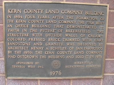
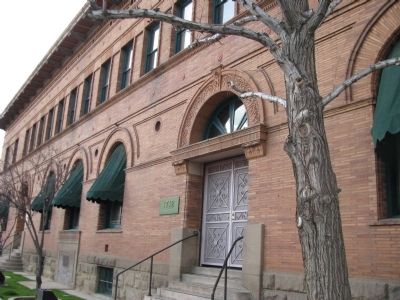
Inscription. In 1894, four years after the formation of the Kern County Land Company, the firm built an office building that demonstrated its "Faith in the Future" of Bakersfield. The structure with outside walls of cream colored pressed brick, trimmed with gray sandstone and granite, was designed by architect Henry A. Schulze of San Francisco. By the 1950s the Kern County Land Company had outgrown the building and sold it in 1959.
 
Erected 1976 by Sponsored by: Tenneco West Inc. and Bakerfield Bicentennial Committee.
 
Topics. This historical marker is listed in these topic lists: Industry & CommerceNotable Buildings. A significant historical year for this entry is 1894.
 
Location. 35° 22.592′ N, 119° 1.306′ W. Marker is in Bakersfield, California, in Kern County. Marker can be reached from 19th Street east of G Street, on the left when traveling east. Touch for map. Marker is at or near this postal address: 1712 19th Street Bakersfield, Ca, Bakersfield CA 93309, United States of America. Touch for directions.
 
Other nearby markers. At least 8 other markers are within walking distance of this marker. Standard Oil Company Building (about 300 feet away, measured in a direct line); Hayden Building (about 300 feet away); Padre Hotel (about 400 feet away); United States Post Office (about 400 feet away); The Fox Theater
Paid Advertisement
Click on the ad for more information.
Please report objectionable advertising to the Editor.
Click or scan to see
this page online
(about 400 feet away); Hay Building (about 400 feet away); Crites Building (about 500 feet away); Southern Hotel (about 700 feet away). Touch for a list and map of all markers in Bakersfield.
 
Kern County Land Company Building Marker image. Click for full size.
Photographed By Denise Boose, February 12, 2012
2. Kern County Land Company Building Marker
Kern County Land Company Building Marker image. Click for full size.
Photographed By Denise Boose, February 12, 2012
3. Kern County Land Company Building Marker
Kern County Land Company Building image. Click for full size.
Photographed By Denise Boose, February 12, 2012
4. Kern County Land Company Building
Kern County Land Company Building Marker image. Click for full size.
Photographed By Denise Boose, March 4, 2012
5. Kern County Land Company Building Marker
 
 
Credits. This page was last revised on June 16, 2016. It was originally submitted on February 12, 2012, by Denise Boose of Tehachapi, California. This page has been viewed 1,122 times since then and 52 times this year. Photos:   1, 2, 3. submitted on February 12, 2012, by Denise Boose of Tehachapi, California.   4. submitted on March 2, 2012, by Denise Boose of Tehachapi, California.   5. submitted on March 5, 2012, by Denise Boose of Tehachapi, California. • Syd Whittle was the editor who published this page.
Share this page.  
Share on Tumblr
m=52573

CeraNet Cloud Computing sponsors the Historical Marker Database.
This website earns income from purchases you make after using our links to Amazon.com. We appreciate your support.
Paid Advertisement
Apr. 26, 2024