Bells in Crockett County, Tennessee — The American South (East South Central)
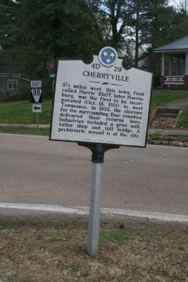
Cherryville
Inscription.
3½ miles west, this town, first called Harris' Bluff, later Harrisburg, was the first to be incorporated (Oct. 18, 1821) in west Tennessee. In 1833, the electors for the surrounding four counties delivered their returns here. Industries included a grist mill, tailor shop and toll bridge. A prehistoric mound is at the site.
Erected by Tennessee Historical Commission. (Marker Number 4D 29.)
Topics and series. This historical marker is listed in this topic list: Settlements & Settlers. In addition, it is included in the Tennessee Historical Commission series list. A significant historical year for this entry is 1833.
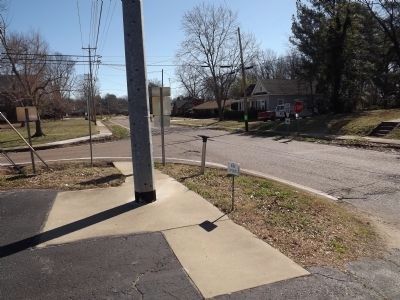
Location. Marker has been reported missing. It was located near 35° 42.744′ N, 89° 5.451′ W. Marker was in Bells, Tennessee, in Crockett County. Marker was at the intersection of Cherryville Road and College Street (Tennessee Route 88), on the right when traveling west on Cherryville Road. Touch for map. Marker was in this post office area: Bells TN 38006, United States of America. Touch for directions.
Other nearby markers. At least 8 other markers are within 9 miles of this location, measured as the crow flies. Robert H. White, Ph. D. (approx. 5.2 miles away); The Original Bank of Alamo Building (approx. 5.2 miles away); Cageville in the Civil War (approx. 5.2 miles away); Crockett County Veterans Memorial (approx. 5.3 miles away); Crockett County's First Court (approx. 5.3 miles away); First Strawberries (approx. 6˝ miles away); Tabernacle (approx. 8.6 miles away); Coxville Church and Cemetery Winfield Scott (Scotty) Moore (approx. 8.7 miles away).
Credits. This page was last revised on June 16, 2016. It was originally submitted on February 27, 2012, by Ken Smith of Milan, Tennessee. This page has been viewed 846 times since then and 37 times this year. Photos: 1, 2, 3. submitted on February 27, 2012, by Ken Smith of Milan, Tennessee. • Bernard Fisher was the editor who published this page.


