Moccasin in Tuolumne County, California — The American West (Pacific Coastal)
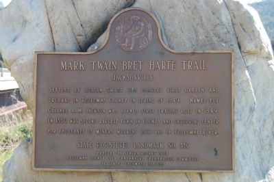
Jacksonville
Mark Twain Bret Harte Trail
Erected 1950 by Sonora Rotary Club and Tuolumne County Gold Centennial Committe. (Marker Number 419.)
Topics and series. This historical marker is listed in this topic list: Settlements & Settlers. In addition, it is included in the Mark Twain Bret Harte Trail, and the Rotary International series lists. A significant historical year for this entry is 1849.
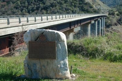
Location. 37° 50.34′ N, 120° 20.815′ W. Marker is in Moccasin, California, in Tuolumne County. Marker is at the intersection of Jacksonville Road and River Road, on the right when traveling south on Jacksonville Road. Touch for map. Marker is at or near this postal address: 12659 Jacksonville Road, Jamestown CA 95327, United States of America. Touch for directions.
Other nearby markers. At least 8 other markers are within 6 miles of this marker, measured as the crow flies. Stevens Bar Bridge (here, next to this marker); a different marker also named Jacksonville (approx. 1.9 miles away); Don Pedro Lake (approx. 1.9 miles away); Ferretti Shrine (approx. 1.9 miles away); Big Oak Flat (approx. 4.8 miles away); Joseph E. Lemos (approx. 5 miles away); Chinese Camp (approx. 5.1 miles away); To Honor Eddie Webb (approx. 5.1 miles away). Touch for a list and map of all markers in Moccasin.
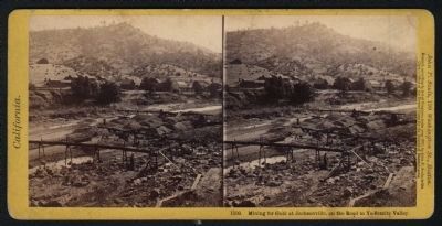
Regarding Jacksonville. Once one of the largest towns in the Mother Lode, the town is now entirely submerged by Lake Don Pedro.
Also see . . . Jacksonville (No. 419 California Historical Landmark). National Geographic: Sierra Nevada Tourism (Submitted on January 1, 2021, by Larry Gertner of New York, New York.)
Credits. This page was last revised on January 1, 2021. It was originally submitted on March 9, 2012, by Barry Swackhamer of Brentwood, California. This page has been viewed 763 times since then and 38 times this year. Last updated on March 14, 2012. Photos: 1, 2, 3. submitted on March 9, 2012, by Barry Swackhamer of Brentwood, California. • Syd Whittle was the editor who published this page.


