Garfield in Pawnee County, Kansas — The American Midwest (Upper Plains)
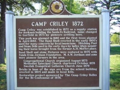
Camp Criley 1872
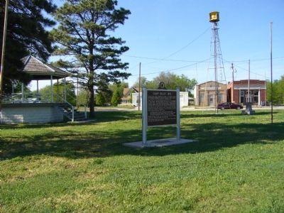
This park was planned in 1880 and the first trees planted in April 1882. The Band Shell erected in the early 1900's used for many concerts by local musicians. Hitching Post and Stone Stile used in the early days by ladies when mounting their horse brought from the former A. H. Moffet place. Band Shell and stone fixtures were restored in 1975 with funds from Jordaan Foundation. M. A. W. Jordaan and sons were pioneer farmers in the area.
Congregational Church organized August 1873 Methodist Episcopal Church chartered October 1878 Swedish Evangelical Lutheran Church June 1879
Bricks in base of the sign are from the school building erected in 1884 and made in local kiln.
Restoration project sponsored by The Camp Criley Belles for the Bi-Centennial of 1976.
Erected by Kansas Historical Society. (Marker Number 110.)
Topics and series. This historical marker is listed in this topic list: Settlements & Settlers. In addition, it is included in the Kansas Historical Society series list. A significant historical month for this entry is April 1882.
Location. 38° 4.519′ N, 99° 14.616′ W. Marker is in Garfield, Kansas, in Pawnee County. Marker is at the intersection of U.S. 56 and 3rd Street, on the left when traveling east on U.S. 56. Touch for map. Marker is in this post office area: Garfield KS 67529, United States of America. Touch for directions.
Other nearby markers. At least 8 other markers are within 8 miles of this marker, measured as the crow flies. A Soldier Town (approx. 7˝ miles away); Doesn't Every Fort Have a Wall? (approx. 7˝ miles away); Well, Adobe Hospital and Hospital Steward's Quarters (approx. 7.6 miles away); Third Infantry Honored Dead (approx. 7.7 miles away); Soldiers Who Died At Fort Larned (approx. 7.7 miles away); The Great Wagon Road to the Southwest (approx. 7.7 miles away); Santa Fe Trail (approx. 7.9 miles away); Fort Larned (approx. 7.9 miles away).
Credits. This page was last revised on June 16, 2016. It was originally submitted on May 11, 2012, by Bill Kirchner of Tucson, Arizona. This page has been viewed 896 times since then and 64 times this year. Photos: 1, 2. submitted on May 11, 2012, by Bill Kirchner of Tucson, Arizona. • Bill Pfingsten was the editor who published this page.

