Prospect in Waldo County, Maine — The American Northeast (New England)
Terreplein
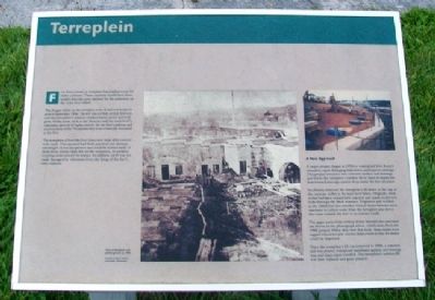
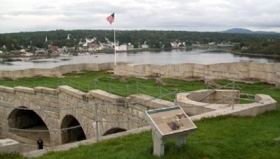
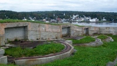
Fort Knox's roof, or terreplein, has emplacements for thirty cannons. These cannons would have been smaller than the guns planned for the casemates on the main level below.
The 30 gun circles on the terreplein were all laid and ready for guns in September 1864. The fort was not fully armed, however, and the terreplein's cannon emplacements never received guns. Other areas, such as the batteries and the main level's casemates, proved of higher priority for the fort's defense and received most of the 74 cannons that were eventually mounted at the fort.
The terrepleins of forts like Fort Knox were most often covered with earth. This material has both practical and strategic advantages. It was inexpensive and could be leveled easily. If shells from enemy ships fell on the terreplein, an earthen covering could absorb the impact. In addition, earth was not easily damaged by vibrations from the firing of the fort's own cannons.
A New Approach
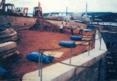
A major project began in 1996 to waterproof Fort Knox's terreplein, repair damaging leaks below, and improve drainage. This project created a new concrete surface and drainage just below the terreplein's earthen fill in order to bypass the deteriorated drainage system deep inside the fort structure.
Machinery removed the terreplein's fill down to the top of the casemate arches in the main level below. Originally, these arches had been coated with concrete and mastic to prevent leaks through the brick masonry. Engineers and workers in the 1860s had also installed vertical drains between each casemate to collect water from the terreplein and direct the water outside the fort or to cisterns inside.
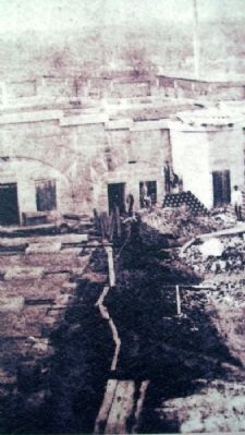
The upper parts of the vertical drains between the casemates are shown in the photograph above, which dates from the 1996 project. When they were first built, these drains were capped with removable circular drain covers so that the drains could be inspected.
Once the terreplein's fill was removed in 1996, a concrete slab was poured, waterproof membrane applied, and drainage mat and drain pipes installed. The terreplein's earthen fill was then replaced and grass planted.
Erected by Maine Department of Conservation.
Topics. This historical marker is listed in this topic list: Forts and Castles. A significant historical month for this entry is September 1864.
Location. 44° 33.952′ N, 68° 48.15′ W. Marker is in Prospect, Maine, in Waldo County. Marker is on the Terreplein inside the fort, at Fort Knox State Historic Site. Touch for map. Marker is at or near this postal address: 711 Fort Knox Road (Maine Route 174), Stockton Springs ME 04981, United States of America. Touch for directions.
Other nearby markers. At least 8 other markers are within walking distance
of this marker. Firing a Cannon (a few steps from this marker); Where Did the Soldiers Sleep? (within shouting distance of this marker); The Heart of the Fort (within shouting distance of this marker); Digging Down and Building Up (within shouting distance of this marker); The Casemate - Key to Fort Design (within shouting distance of this marker); Fort Knox (within shouting distance of this marker); A Grand Plan (within shouting distance of this marker); A Question of Boundaries (within shouting distance of this marker). Touch for a list and map of all markers in Prospect.
Also see . . . Fort Knox State Historic Site, Maine. (Submitted on May 13, 2012, by William Fischer, Jr. of Scranton, Pennsylvania.)
Credits. This page was last revised on September 24, 2020. It was originally submitted on May 13, 2012, by William Fischer, Jr. of Scranton, Pennsylvania. This page has been viewed 583 times since then and 14 times this year. Photos: 1, 2, 3, 4, 5. submitted on May 13, 2012, by William Fischer, Jr. of Scranton, Pennsylvania.
