Junction City in Trinity County, California — The American West (Pacific Coastal)
Junction City Centennial
1896 – 1996
[Upper Marker:]
On this site in 1852 a group of early settlers formed a mining community. The called it Milltown after the Seeley and Dowles water powered sawmill located near the mouth of Canyon Creek. In September 1861 this rapidly growing village was re-named Junction City due to the junction of Canyon Creek with the Trinity River and because of the many trails that served the outlying areas. President Grover Cleveland signed the official records establishing this townsite on January 18, 1896.
[Lower Marker:]
Monument erected by the Trinitarianus Chapter #62, Ancient and Honorable Order of E Clampus Vitus
Erected by E Clampus Vitus, Trinitarianus Chapter 62.
Topics and series. This historical marker is listed in this topic list: Settlements & Settlers. In addition, it is included in the E Clampus Vitus, and the Former U.S. Presidents: #22 and #24 Grover Cleveland series lists. A significant historical month for this entry is January 1850.
Location. 40° 43.813′ N, 123° 3.304′ W. Marker is in Junction City, California, in Trinity County. Marker is on Route 229 just north of Canyon Creek Road, on the right when traveling south. Touch for map. Marker is in this post office area: Junction City CA 96048, United States of America. Touch for directions.
Other nearby markers. At least 8 other markers are within 6 miles of this marker , measured as the crow flies. The La Grange Mine (approx. 3.1 miles away); Moving Mountains... (approx. 3.2 miles away); Bagdad (approx. 4.6 miles away); Old Section (approx. 5.8 miles away); Weaverville Basin Gold Discovery Site (approx. 5.9 miles away); I.O.O.F. Hall (approx. 6 miles away); Spiral Staircases (approx. 6 miles away); Trinity County Courthouse (approx. 6 miles away).
Regarding Junction City Centennial. "In May 2006, the Junction Fire scorched 3,500 acres (14 km2), then later combined with the Bar Fire, making that 100,000 acres (400 km2). Some areas of the Bar Fire are still smoldering in very remote areas. The Junction Fire threatened all of Junction City, and even some parts of the town of Weaverville.
On July 20, 2008 fire threatened communities near Junction City; some areas were under mandatory evacuation. Many huge forest fires broke out because of a lighting storm which occurred on June 20, 2008 in Northern California." Junction City - Wikipedia

Photographed By Barry Swackhamer, June 2, 2012
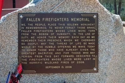
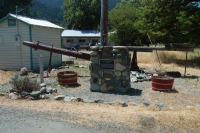
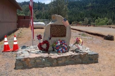
3. Fallen Firefighters Memorial
We, the people, place this solemn monument in remembrance; to never forget those brave fallen firefighters whose lives were torn from the bosom of humanity, in the line of duty. We honor their memory each day as we remember their presence, which we cherished so deeply. May the thread of life be made whole by the humble offering we make today to honor those who have already given the greatest sacrifice and for those who may perish; from this day forward. Dedicated to the firefighters whose lives were lost in the horrific wildland fires of 2008
September 13, 2008
Credits. This page was last revised on June 16, 2016. It was originally submitted on June 7, 2012, by Barry Swackhamer of Brentwood, California. This page has been viewed 475 times since then and 16 times this year. Photos: 1, 2, 3, 4. submitted on June 7, 2012, by Barry Swackhamer of Brentwood, California. • Syd Whittle was the editor who published this page.


