Old Sacramento in Sacramento County, California — The American West (Pacific Coastal)
Lady Adams Building
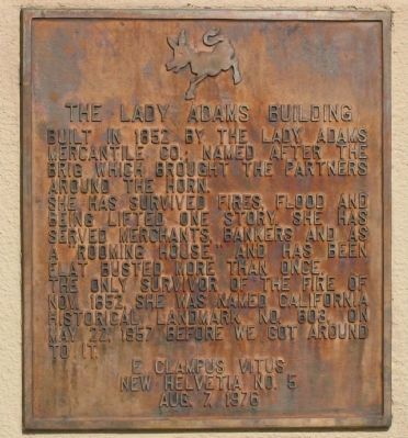
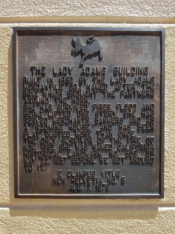
Built in 1852 by the Lady Adams Mercantile Co.; named after the brig which brought the partners around the horn. She has survived fires, flood, and being lifted one story. She has served merchants, bankers, and as a “rooming house”. And has been flat busted more than once. The only survivor of the fire of 1852. She was named California Historical Landmark No. 603 on May 22, 1957 before we got around to it.
Erected 1976 by E Clampus Vitus, New Helvetia No. 5 (Aug. 7, 1976). (Marker Number 603.)
Topics and series. This historical marker is listed in these topic lists: Industry & Commerce • Landmarks • Notable Buildings • Settlements & Settlers. In addition, it is included in the California Historical Landmarks, and the E Clampus Vitus series lists. A significant historical month for this entry is May 1905.
Location. 38° 34.942′ N, 121° 30.316′ W. Marker is in Sacramento, California, in Sacramento County. It is in Old Sacramento. Marker can be reached from the intersection of K Street and Commonwealth Avenue. Touch for map. Marker is at or near this postal address: 117 - 119 "K" Street, Sacramento CA 95814, United States of America. Touch for directions.
Other nearby markers. At least 8 other markers are within walking distance of this marker. Mile Marker 0 (about 300 feet away, measured in a direct line); Sacramento Engine Company No. 3 (about 300 feet away); Pony Express River Steamer “Antelope” (about 300 feet away); Booth Building (about 300 feet away); Vernon-Brannan House (about 300 feet away); Early Native Americans (about 300 feet away); Early Explorers (about 400 feet away); The Arrival of Sutter (about 400 feet away). Touch for a list and map of all markers in Sacramento.
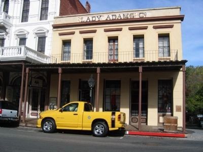
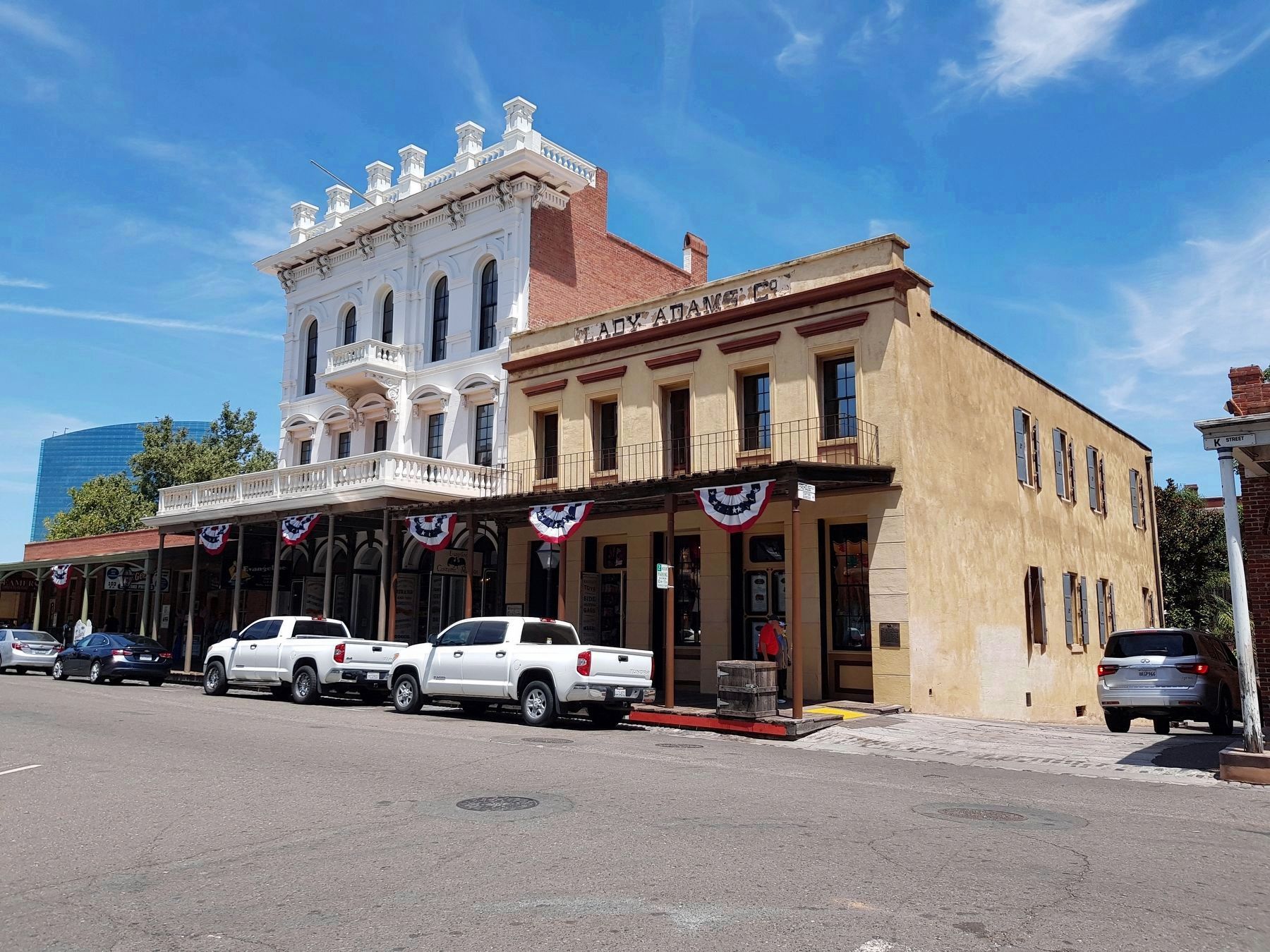
Regarding Lady Adams Building. The Lady Adams Building is a California Registered Historical Landmark (No. 603).
The first owners of the Lady Adams Building were two German merchants who came to California “around the horn” on a ship named The Lady Adams. After setting up their business in a tent, they had the building built using much of the ship’s parts as building material. The bricks used in the building had acted as the ships ballast and the mast was used as a “backing up” place for wagons and horses to back up to. Because of its brick roofing it survived the “great fire of 1852”. It also survived the floods that occurred almost annually until the streets were raised in the 1860’s and is considered to be Old Sacramento’s oldest building.
In the 1950’s Old Sacramento went through its “skid row” days and the Lady Adams was a flop house and also a brothel. It eventually was unused and fell into total disrepair. In 1970 the brick roof collapsed and damaged the building.
This proud old building was restored and now serves as a retail business in the bustling rejuvenated Old Sacramento State Historical State Park.
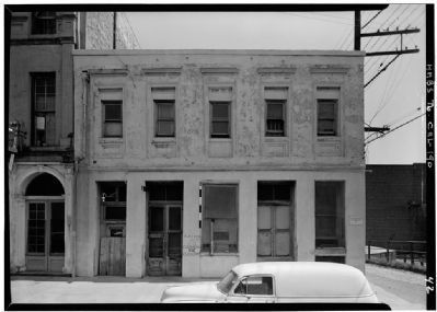
Photographed By Glen Fishback, Photographer, circa July, 1965
4. Lady Adams Building
From the Historic American Buildings Survey - Library of Congress
Click for more information.
Click for more information.
Credits. This page was last revised on February 7, 2023. It was originally submitted on September 7, 2008, by Syd Whittle of Mesa, Arizona. This page has been viewed 2,466 times since then and 99 times this year. Last updated on August 20, 2012. Photos: 1. submitted on September 7, 2008, by Syd Whittle of Mesa, Arizona. 2. submitted on July 6, 2019, by J. Makali Bruton of Accra, Ghana. 3. submitted on September 7, 2008, by Syd Whittle of Mesa, Arizona. 4. submitted on April 4, 2009, by Syd Whittle of Mesa, Arizona. 5. submitted on July 6, 2019, by J. Makali Bruton of Accra, Ghana.
