Dardenelle in Tuolumne County, California — The American West (Pacific Coastal)
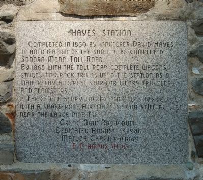
Hayes Station
By 1865 with the toll road completed, wagons, stages, and pack trains used the station as a mail, relay, and rest stop for weary travelers and teamsters.
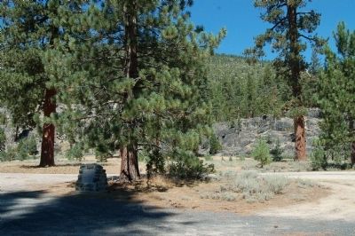
The single story log building was 18 x 50 ft. with a shake roof. A remainder can still be seen near the large pine tree.
Erected 1986 by E Clampus Vitus, Matuca Chapter 1849.
Topics and series. This historical marker is listed in this topic list: Notable Places. In addition, it is included in the E Clampus Vitus series list. A significant historical year for this entry is 1860.
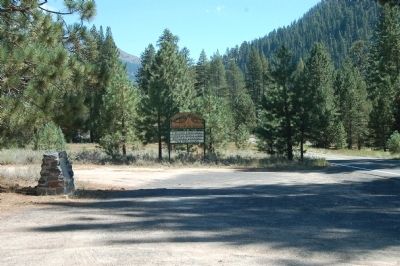
Location. 38° 20.44′ N, 119° 46.96′ W. Marker is in Dardenelle, California, in Tuolumne County. Marker is on Sonora Pass Highway (State Highway 108), on the left when traveling east. This marker is next to the highway in Eureka Valley. Touch for map. Marker is in this post office area: Pinecrest CA 95364, United States of America. Touch for directions.
Other nearby markers. At least 8 other markers are within 15 miles of this marker, measured as the crow flies. Jewels of the High Country (approx. 2.9 miles away); The Emigrants of 1852-1853 (approx. 2.9 miles away); Following in their Footsteps - East Flange Rock (approx. 3.1 miles away); Route of the Bartleson-Bidwell Party - 1841 (approx. 7.7 miles away); The Last Battle (approx. 7.7 miles away); Sonora Pass (approx. 7.9 miles away); Sonora Mono Toll Road (approx. 7.9 miles away); Earl Purdy (approx. 14.1 miles away).
Regarding Hayes Station. Oldest of the trans-Sierra emigrant trails to California crossed over the spectacular Sonora Pass. Today’s Highway 108 is much the same route as the Old Sonora-Mono Toll Road.
Also see . . . Sonora Pass-Mono Road (No. 422 California Historical Landmark). National Geographic "Sierra Nevada Tourism" entry (Submitted on December 27, 2020, by Larry Gertner of New York, New York.)
Credits. This page was last revised on December 27, 2020. It was originally submitted on August 27, 2012, by Barry Swackhamer of Brentwood, California. This page has been viewed 840 times since then and 32 times this year. Photos: 1, 2, 3. submitted on August 27, 2012, by Barry Swackhamer of Brentwood, California. • Syd Whittle was the editor who published this page.
Editor’s want-list for this marker. Close up photo of the remains. • Can you help?


