Washington in Washington County, Utah — The American Mountains (Southwest)
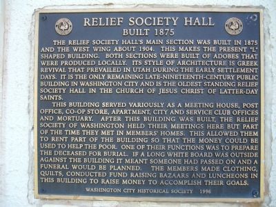
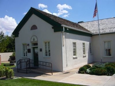
Relief Society Hall
Built 1875
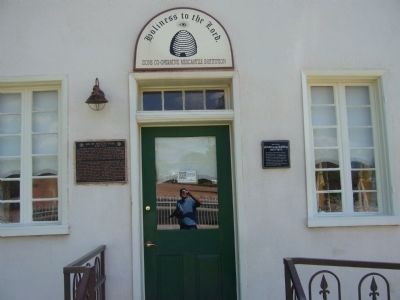
This building served variously as a meeting house, post office, co-op store, apartment, city and service club offices and mortuary. After this building was built, the Relief Society of Washington held their meetings here but part of the time they met in members' homes. This allowed them to rent part of the building so that the money could be used to help the poor. One of their functions was to prepare the deceased for burial. If a long white board was outside against the building it meant someone had passed on and a funeral would be planned. The members made clothing, quilts, conducted fund raising bazaars and luncheons in this building to raise money to accomplish their goals.
Erected 1996 by Washington City Historical Society.
Topics. This historical marker is listed in these topic lists: Churches & Religion • Notable Buildings. A significant historical year for this entry is 1875.
Location. 37° 7.807′ N, 113° 30.677′ W. Marker is in Washington, Utah, in Washington County. Marker is at the intersection of West Telegraph Street and South 100 West, on the right when traveling east on West Telegraph Street. The building is on the southeast corner. Touch for map. Marker is in this post office area: Washington UT 84780, United States of America. Touch for directions.
Other nearby markers. At least 8 other markers are within walking distance of this marker. ZCMI Co-op Building (here, next to this marker); Thomas W. Smith's Corn Cracker & Grist Millstone (a few steps from this marker); Prominent Pioneer Men and Women Who Helped Settle Washington City (about 500 feet away, measured in a direct line); Washington City 1857 (about 600 feet away); Telegraph Street / Millcreek Mills (about 600 feet away); The Granary (about 700 feet away); Utah’s Dixie Birthplace, Washington City (about 700 feet away); “Utah’s Dixie” Washington City (about 700 feet away). Touch for a list and map of all markers in Washington.
Credits. This page was last revised on June 16, 2016. It was originally submitted on September 9, 2012, by Bill Kirchner of Tucson, Arizona. This page has been viewed 431 times since then and 27 times this year. Photos: 1, 2, 3. submitted on September 9, 2012, by Bill Kirchner of Tucson, Arizona. • Syd Whittle was the editor who published this page.


