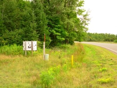
Near Mercer in Iron County, Wisconsin — The American Midwest (Great Lakes)
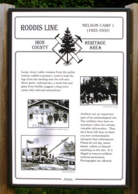
Roddis Line – Nelson Camp 1 (1925-1930)
Iron County Heritage Area
Artifacts are an important part of an archaeological site. The artifacts here have no monetary value but contain valuable information. They have been left here to show you how archaeologists interpret that information. Please do not dig, metal detect, collect or disturb anything on the site. It is illegal to remove artifacts without permission. Photographs are allowed.
Topics. This historical marker is listed in these topic lists: Industry & Commerce • Railroads & Streetcars.
Location. 46° 4.914′ N, 90° 16.263′ W. Marker is near Mercer, Wisconsin, in Iron County. Marker is on County Route FF, half a mile north of Turtle Flambeau Dam Road, on the right when traveling north. Touch for map. Marker is in this post office area: Butternut WI 54514, United States of America. Touch for directions.
Other nearby markers. At least 8 other markers are within 7 miles of this marker, measured as the crow flies. Roddis Line - Roddis Lumber and Veneer Company (here, next to this marker); Roddis Line – Early Logging (here, next to this marker); Roddis Line – Life in Camp (here, next to this marker); a different marker also named Roddis Line – Nelson Camp 1 (1925-1930) (here, next to this marker); a different marker also named Roddis Line - Roddis Lumber and Veneer Company (here, next to this marker); Flambeau Trail – Turtle Flambeau Flowage Dam (approx. 1.7 miles away); Roddis Line – Turtle-Flambeau Dam (approx. 1.8 miles away); Flambeau Trail – Two Ways to Go (approx. 7.1 miles away). Touch for a list and map of all markers in Mercer.
Credits. This page was last revised on June 16, 2016. It was originally submitted on September 14, 2012, by Paul Fehrenbach of Germantown, Wisconsin. This page has been viewed 545 times since then and 13 times this year. Photos: 1, 2, 3, 4, 5. submitted on September 14, 2012, by Paul Fehrenbach of Germantown, Wisconsin. • Bernard Fisher was the editor who published this page.
