Enoch in Iron County, Utah — The American Mountains (Southwest)
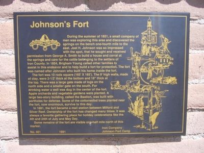
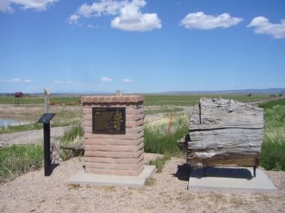
Johnson's Fort
The fort was 10 rods square (165' x 165'). The 9' high walls, made of clay, were 2 1/2' thick at the bottom and 18" thick at the top. There was a large gate made of logs on the north side and a smaller gate on the south. For drinking water a well was dug in the center of the fort. Apple orchards and vegetable gardens were planted. A large two-story building, called the Bastion, was built with portholes for defense. Some of the cottonwood trees planted near the fort, now enormous, survive to this day.
In 1881, the fort became a mail station between Milford and Silver Reef. Ownership of the fort has changed many times. It was always a favorite gathering place for holiday celebrations like the 4th and 24th of July and May Day.
Some remains of the fort are visible one-half mile north of this marker.
Erected 1991 by Iron Camp, Johnson Fort Camp – Daughters of Utah Pioneers. (Marker Number 461.)
Topics and series. This historical marker is listed in these topic lists: Forts and Castles • Settlements & Settlers. In addition, it is included in the Daughters of Utah Pioneers series list. A significant historical year for this entry is 1851.
Location. 37° 46.325′ N, 113° 1.931′ W. Marker is in Enoch, Utah, in Iron County. Marker is on Jones Road, 0.4 miles west of Enoch Road, on the right when traveling west. Touch for map. Marker is in this post office area: Cedar City UT 84721, United States of America. Touch for directions.
Other nearby markers. At least 8 other markers are within 6 miles of this marker, measured as the crow flies. Enoch Schoolhouse and Tithing Office (approx. 0.3 miles away); Jones Iron Works Park (approx. 0.7 miles away); First Cedar Encampment (approx. 5.3 miles away); Sylvanus Cyrus Hulet (approx. 5.7 miles away); Cedar City Historic Pioneer Cemetery Wall (approx. 5.9 miles away); The Caboose (approx. 6 miles away); The Ore Shovel (approx. 6 miles away); Legacies of Iron County (approx. 6 miles away). Touch for a list and map of all markers in Enoch.
Credits. This page was last revised on June 16, 2016. It was originally submitted on September 17, 2012, by Bill Kirchner of Tucson, Arizona. This page has been viewed 907 times since then and 56 times this year. Photos: 1, 2. submitted on September 17, 2012, by Bill Kirchner of Tucson, Arizona. • Syd Whittle was the editor who published this page.
Editor’s want-list for this marker. Photo of the fort remains. • Photo of the Cottonwood Trees • Can you help?

