Bladensburg in Prince George's County, Maryland — The American Northeast (Mid-Atlantic)
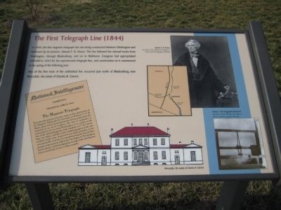
The First Telegraph Line (1844)
In 1844, the first magnetic telegraph line was being constructed between Washington and Baltimore by its inventor, Samuel F. B. Morse. The line followed the railroad tracks from Washington, through Bladensburg, and on to Baltimore. Congress had appropriated $30,000 in 1843 for the experimental telegraph line, and construction on it commenced in the spring of the following year.
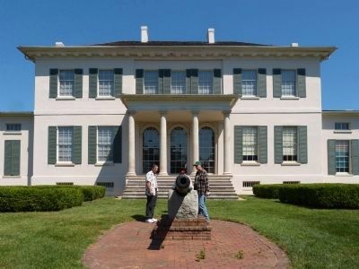
One of the first tests of the unfinished line occurred just north of Bladensburg near Riversdale, the estate of Charles B. Calvert.
Text in lower-left box: National Intelligencer, Washington, Wednesday, April 10, 1844. The Magnetic Telegraph. Considerable progress has been made in the construction of the Magnetic Telegraph, the invention of Professor S. F. B. Morse, upon which a test experiment is being made under the authority of an act of Congress. The line of conductors is constructed as far on from Washington to a point on the line of the rairoad opposite to the residence of C. B. Calvert, Esq., (six miles,) and the work is making progress at the rate of about a mile a day. A trial of it was made yesterday, as the cars passed Mr. Calvert's by communicating the fact of their passage to the point at which the line begin in Washington, and an answer, acknowledging the receipt of the intelligence, was received back in two or three seconds.
Text with lower middle picture: Riversdale, the estate of Charles B. Calvert.
Text with upper right photo: Samuel F. B. Morse. Courtesy of the Library of Congress, Prints and Photographs Division.
Text with lower right photo: Morse's 1837 telegraph instrument. Courtesy of the Library of Congress, Prints and Photographs Division.
Topics. This historical marker is listed in this topic list: Communications. A significant historical date for this entry is April 10, 1814.
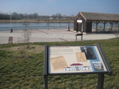
Location. 38° 56.077′ N, 76° 56.294′ W. Marker is in Bladensburg, Maryland, in Prince George's County. Marker can be reached from the intersection of Annapolis Road (Maryland Route 450) and 46th Street. Marker is in Bladensburg Waterfront Park, .2 miles south of the entrance at this intersection. Touch for map. Marker is in this post office area: Bladensburg MD 20710, United States of America. Touch for directions.
Other nearby markers. At least 8 other markers are within walking distance of this marker. Colonial Ropemaking (a few steps from this marker); Joshua Barney's Barge and the Chesapeake Flotilla (within shouting distance of this marker); Clearing the Way to Washington (within shouting distance of this marker); Bladensburg Floods (1742-1954) (within shouting distance of this marker); Encampment of Coxey's Army (1894) (within shouting distance of this marker); Duels and the Bladensburg Dueling Grounds (within shouting distance of this marker); Dinosaur Alley (within shouting distance of this marker); The Incidental Cause of the Star-Spangled Banner (1814) (within shouting distance of this marker). Touch for a list and map of all markers in Bladensburg.
More about this marker. Riversdale, the location where the test was made, is about 2 miles north of the Bladensburg Waterfront Park.
Also see . . .
1. Baltimore–Washington telegraph line. Wikipedia entry (Submitted on July 16, 2023, by Larry Gertner of New York, New York.)
2. Bladensburg Waterfront Park. Maryland-National Capital Park And Planning Commission Parks & Recreation website entry (Submitted on March 9, 2008, by F. Robby of Baltimore, Maryland.)
Credits. This page was last revised on September 9, 2023. It was originally submitted on March 9, 2008, by F. Robby of Baltimore, Maryland. This page has been viewed 9,235 times since then and 116 times this year. Photos: 1, 2. submitted on March 9, 2008, by F. Robby of Baltimore, Maryland. 3. submitted on September 8, 2013, by Allen C. Browne of Silver Spring, Maryland.


