Marker Logo HMdb.org THE HISTORICAL
MARKER DATABASE
“Bite-Size Bits of Local, National, and Global History”
Oak Harbor in Island County, Washington — The American West (Northwest)
 

Deception Pass


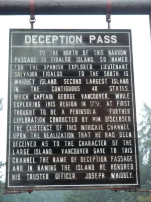
Deception Pass Marker image. Click for full size.
Photographed By Barry Swackhamer, October 31, 2012
1. Deception Pass Marker
Inscription. To the north of this narrow passage is Fidalgo Island, so named for the Spanish explorer, Lieutenant Salvador Fidalgo. To the south is Whidbey Island, second largest island in the contiguous 48 states, which Captain George Vancouver, while exploring this region in 1792, first thought to be a peninsula. Further exploration conducted by him disclosed the existence of this intricate channel. Upon realization that he had been deceived as to the character of the large island, Vancouver gave to this channel the name of Deception Passage and in naming the island he honored his trusted officer, Joseph Whidbey.
 
Erected by Washington State Department of Transportation. (Marker Number 3.)
 
Topics. This historical marker is listed in this topic list: Exploration. A significant historical year for this entry is 1792.
 
Location. 48° 24.274′ N, 122° 38.683′ W. Marker is in Oak Harbor, Washington, in Island County. Marker is on Deception Pass Bridge (Washington Route 20). This marker is located in the pull-out at the south end of the Deception Pass Bridge. Touch for map. Marker is at or near this postal address: 42999 Deception Pass Bridge, Oak Harbor WA 98277, United States of America. Touch for directions.
 
Other nearby markers. At least 8 other markers are within 7 miles of this marker, measured as the crow flies. A different marker also named Deception Pass (within shouting distance of this marker); a different marker
Paid Advertisement
Click on the ad for more information.
Please report objectionable advertising to the Editor.
Click or scan to see
this page online
also named Deception Pass (approx. 0.2 miles away); a different marker also named Deception Pass (approx. 0.2 miles away); Crossing the Pass (approx. 0.2 miles away); a different marker also named Deception Pass (approx. 0.4 miles away); U.S. Navy Patrol and Reconnaissance Memorial (approx. 4˝ miles away); Douglas Fir (approx. 5.9 miles away); Town of La Conner 1873-1914 (approx. 6.8 miles away). Touch for a list and map of all markers in Oak Harbor.
 
Deception Pass Marker image. Click for full size.
Photographed By Barry Swackhamer, October 31, 2012
2. Deception Pass Marker
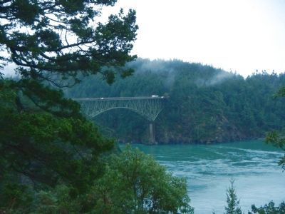
Deception Pass image. Click for full size.
Photographed By Barry Swackhamer, October 31, 2012
3. Deception Pass
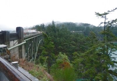
Deception Pass Bridge, north side image. Click for full size.
Photographed By Barry Swackhamer, October 31, 2012
4. Deception Pass Bridge, north side
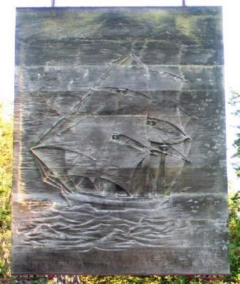
Deception Pass Marker (back) image. Click for full size.
Photographed By William Fischer, Jr., May 19, 2014
5. Deception Pass Marker (back)
 
 
Credits. This page was last revised on January 27, 2020. It was originally submitted on November 6, 2012, by Barry Swackhamer of Brentwood, California. This page has been viewed 526 times since then and 20 times this year. Photos:   1, 2, 3, 4. submitted on November 6, 2012, by Barry Swackhamer of Brentwood, California.   5. submitted on May 29, 2014, by William Fischer, Jr. of Scranton, Pennsylvania. • Syd Whittle was the editor who published this page.
Share this page.  
Share on Tumblr
m=60903

CeraNet Cloud Computing sponsors the Historical Marker Database.
This website earns income from purchases you make after using our links to Amazon.com. We appreciate your support.
Paid Advertisement
Apr. 26, 2024