Stonycreek Township near Indian Lake in Somerset County, Pennsylvania — The American Northeast (Mid-Atlantic)
Flight 93 National Memorial
National Park Service, U.S.Department of the Interior
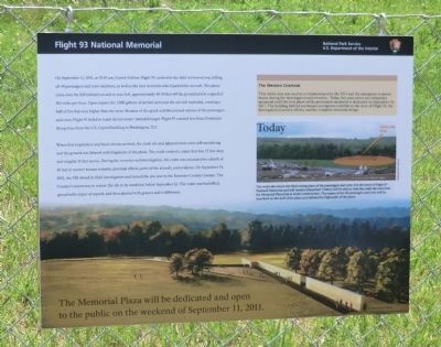
On September 11, 2001, at 10:30 am, United Airlines Flight 93 crashed in the field in front of you, killing all 40 passengers and crew members, as well as the four terrorists who hijacked the aircraft. The plane came over the hill behind you and to your left, approximately 40-50 feet off the ground and at a speed of 563 miles per hour. Upon impact the 7,000 gallons of jet fuel on board the aircraft exploded, creating a ball of fire that rose higher than the trees. Because of the quick and determined actions of the passengers and crew, Flight 93 failed to reach the terrorists’ intended target. Flight 93 crashed less than 20 minutes flying-time from the U.S. Capitol building in Washington, D.C.
When first responders and local citizens arrived, the crash site and adjacent trees were still smoldering and the ground was littered with fragments of the plane. The crash created a crater that was 15 feet deep and roughly 30 feet across. During the recovery and investigation, the crater was excavated to a depth of 40 feet to recover human remains, personal effects, parts of the aircraft, and evidence. On September 24, 2001, the FBI closed its field investigation and turned the site over to the Somerset County Coroner. The Coroner’s intent was to restore the site to its condition before September 11. The crater was backfilled, spread with a layer of topsoil, and then planted with grasses and wildflowers.
The Western Overlook
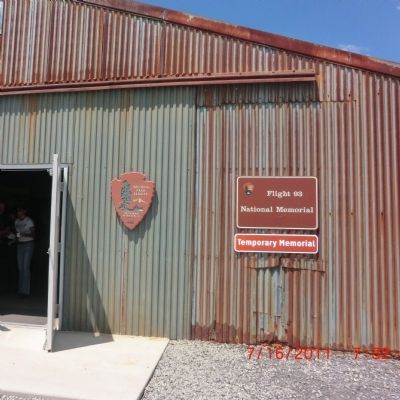
This entire area was used as a command post by the F.B.I. and the emergency response teams during the investigation and recovery. Today, this area serves as a temporary memorial until the first phase of the permanent memorial is dedicated on September 10, 2011. The building behind you houses a temporary exhibit on the story of Flight 93, the investigation/recovery efforts, and the complete memorial design.
Today
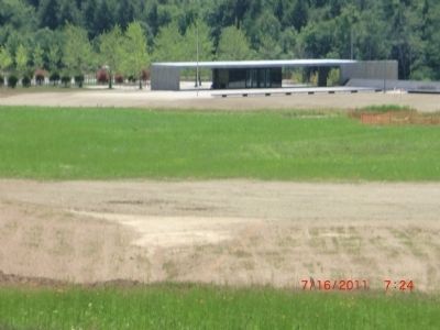
The crash site area is the final resting place of the passengers and crew. It is the heart of Flight 93 National Memorial and will remain untouched. Visitors will be able to view the crash site area from the Memorial Plaza that is under construction. The names of the 40 passengers and crew will be inscribed on the wall of the plaza as it follows the flight of the plane.
The Memorial Plaza will be dedicated and open to the public on the weekend of September 11, 2011.
Topics. This memorial is listed in these topic lists: 9/11 Attacks • Air & Space. A significant historical date for this entry is September 11, 2001.
Location. 40° 3.324′ N, 78° 54.006′ W. Marker is near Indian Lake, Pennsylvania, in Somerset County. It is in Stonycreek Township. Memorial is on Skyline Road. Touch for map. Marker is at or near this postal address: 192 Rollock Rd, Stoystown PA 15563, United States of America. Touch for directions.
Other nearby markers. At least 8 other markers are within walking distance of this marker. Overlooking History (within shouting distance of this marker); Flight 93 Temporary Memorial (within shouting distance of this marker); Flight 93 (approx. 0.3 miles away); Welcome To Flight 93 National Memorial (approx. 0.3 miles away); Welcome to the Memorial Plaza (approx. 0.3 miles away); First View (approx. 0.3 miles away); The Investigation (approx. 0.3 miles away); "In the cockpit. If we don't, we'll die!" (approx. 0.3 miles away). Touch for a list and map of all markers in Indian Lake.
Credits. This page was last revised on February 7, 2023. It was originally submitted on November 16, 2012, by Don Morfe of Baltimore, Maryland. This page has been viewed 702 times since then and 22 times this year. Photos: 1, 2, 3, 4. submitted on November 16, 2012, by Don Morfe of Baltimore, Maryland. • Bill Pfingsten was the editor who published this page.


