Frankfort in Franklin County, Kentucky — The American South (East South Central)
Gone But Not Forgotten – Frankfort’s “Craw”
Inscription.
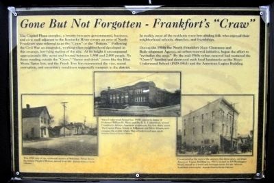
The Capitol Plaza complex, a twenty-two-acre government, business, and civic mall adjacent to the Kentucky River covers an area of North Frankfort once referred to as the “Craw” or the “Bottom.” Following the Civil War an integrated, working-class neighborhood developed in this swampy, low-lying section of the city. At its height it encompassed approximately fifty acres and housed between 1,500 and 2,000 people. To those residing outside the “Craw,” “dance and drink” joints like the Blue Moon, Tiptoe Inn, and the Peach Tree Inn represented the vice, moral corruption, and unsanitary conditions supposedly rampant in the district.
In reality, most of the residents were law-abiding folk who enjoyed their neighborhood schools, churches, and friendships.
During the 1950s the North Franklin Slum Clearance and Redevelopment Agency, an urban-renewal initiative, began the effort to “revitalize the area.” By the mid-1960s urban renewal had scattered the “Craw’s” families and destroyed such local landmarks as the Mayo-Underwood School (1929-1963) and the American Legion Building.
(captions)
This 1940 view of the residential section of Wilkinson Street shows the former People’s Mission, second from the left. Kentucky Historical Society Collection.
Mayo-Underwood School (ca. 1930) named in honor of Professor William H. Mayo and Dr. E.E. Underwood, served Frankfort’s African American community for over thirty years. The Capital Plaza Tower, at Wilkinson and Mero Streets, now occupies the corner where Mayo-Underwood once stood. Kentucky Historical Society Collection.
Constructed at the turn of the century, this three-story, cut-stone American Legion Building (ca. 1917), located at 429 Washington Street, served as a social and business center for the African American community. Kentucky Historical Society Collection.
Topics. This historical marker is listed in these topic lists: African Americans • Settlements & Settlers. A significant historical year for this entry is 1940.
Location. 38° 12.238′ N, 84° 52.703′ W. Marker is in Frankfort, Kentucky, in Franklin County. Marker can be reached from Wilkinson Boulevard (U.S. 421) north of West Plaza Connector Road (U.S. 127), on the right when traveling south. Located along the Riverview Trail in Kentucky River View Park. Touch for map. Marker is at or near this postal address: 404 Wilkinson Blvd, Frankfort KY 40601, United States of America. Touch for directions.
Other nearby markers. At least 8 other markers are within walking distance of this marker. Fort Hill Overlooking the Kentucky River (within shouting distance of this marker); List of CSO Points in Frankfort (within shouting distance of this marker); Kentucky River Water Trail
(within shouting distance of this marker); History of Kentucky's Formation (within shouting distance of this marker); Dry Stone Masonry in Kentucky (about 300 feet away, measured in a direct line); Plantation Era Fence (about 400 feet away); Kentucky Edge Fence (about 400 feet away); Welcome to Kentucky River View Park! (about 500 feet away). Touch for a list and map of all markers in Frankfort.
Credits. This page was last revised on June 16, 2016. It was originally submitted on January 1, 2013, by Bernard Fisher of Richmond, Virginia. This page has been viewed 868 times since then and 55 times this year. Photos: 1, 2. submitted on January 1, 2013, by Bernard Fisher of Richmond, Virginia.

