Gwynns Falls/Leakin Park in Baltimore, Maryland — The American Northeast (Mid-Atlantic)
An Old Mill Stream
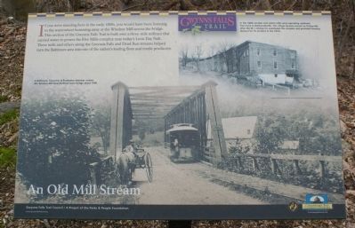
If you were standing here in the early 1800s, you would have been listening to the waterwheel humming away at the Windsor Mill across this bridge. This section of the Gwynns Falls Trail is built over a three-mile millrace that carried water to power the Five Mills complex near today's Leon Day Park. These mills and others alon-e the Gwynns falls and Dead Run streams helped turn the Baltimore area into one of the nation's leading flour and textile producers.
[photograph]
A Baltimore, Calverton & Powhatan streetcar crosses the Windsor Mill Road Bollman truss bridge about 1900.
[photograph]
In the 1800s woolen and cotton mills were operating upstream from here in Wetheredsville. The village became known as Dickeysville after the W.J. Dickey Co. purchased the complex and provided housing (below) for its workers in the 1870s.
Erected by Gwynns Falls Trail Council.
Topics and series. This historical marker is listed in this topic list: Industry & Commerce. In addition, it is included in the Maryland, Gwynns Falls Trail series list. A significant historical year for this entry is 1900.
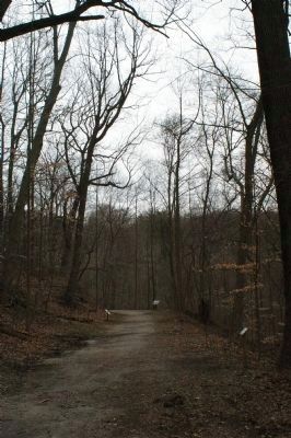
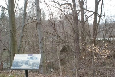
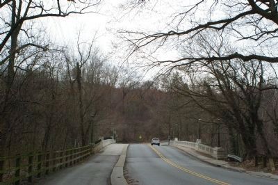
Location. 39° 18.712′ N, 76° 41.326′ W. Marker is in Baltimore, Maryland. It is in Gwynns Falls/Leakin Park. Marker can be reached from Windsor Mill Road. Marker may be accessed by a short trail from a parking lot on the south side of the road. Marker is to the west of the parking lot. Touch for map. Marker is at or near this postal address: 4300 Windsor Mill Rd, Baltimore MD 21216, United States of America. Touch for directions.
Other nearby markers. At least 8 other markers are within walking distance of this marker. Seeing the Forest for the Trees (a few steps from this marker); Gwynns Falls Park at Windsor Mill Road (within shouting distance of this marker); Dickeyville's Historic Legacy (about 500 feet away, measured in a direct line); Leakin Park at Winans Meadow (approx. 0.6 miles away); A Name Before a Place (approx. 0.6 miles away); Crimea Estate (approx. 0.6 miles away); Norman Van Allan Reeves (approx. 0.7 miles away); Leakin Park at the Crimea Estate (approx. 0.7 miles away). Touch for a list and map of all markers in Baltimore.
Also see . . .
1. Image of the marker. (Submitted on March 17, 2008, by Christopher Busta-Peck of Shaker Heights, Ohio.)
2. Gwynns Falls Trail Council. (Submitted on March 17, 2008, by Christopher Busta-Peck of Shaker Heights, Ohio.)
Photographed By Christopher Busta-Peck, March 18, 2008
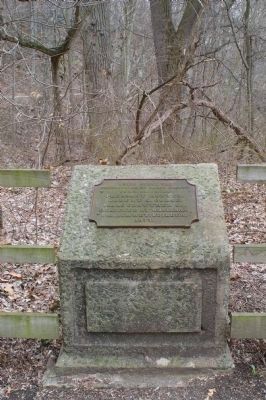
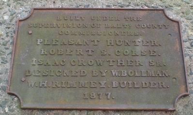
6. Bollman Bridge plaque
This is all that remains of the previous bridge here over the Gwynns Falls. It can be seen in the photo on the marker, about halfway up the right side of the bridge. It reads:
Built under the
supervision of Balto. County
Commissioners.
Pleasant Hunter
Robert S. Corse
Isaac Crowther, Sr.
Designed by W. Bollman
W. H. Rimmey, Builder
1877
supervision of Balto. County
Commissioners.
Pleasant Hunter
Robert S. Corse
Isaac Crowther, Sr.
Designed by W. Bollman
W. H. Rimmey, Builder
1877
Credits. This page was last revised on February 16, 2021. It was originally submitted on March 17, 2008, by Christopher Busta-Peck of Shaker Heights, Ohio. This page has been viewed 3,122 times since then and 65 times this year. Photos: 1, 2, 3, 4, 5, 6. submitted on March 19, 2008, by Christopher Busta-Peck of Shaker Heights, Ohio.
