Marker Logo HMdb.org THE HISTORICAL
MARKER DATABASE
“Bite-Size Bits of Local, National, and Global History”
near Mikesville in Columbia County, Florida — The American South (South Atlantic)
 

Town of Leno


Town of Leno Marker image. Click for full size.
Photographed By Mike Stroud, March 20, 2013
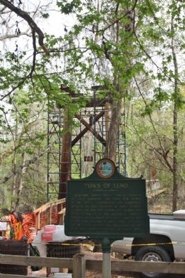
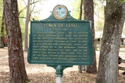
1. Town of Leno Marker
Inscription. Originally called "Keno", for a variation of lotto gambling, the town was settled in the 1860's. Ecclesiastical and commercial pressure changed the name to "Leno" in 1876. A grist and saw mill, cotton gin, stores, and hotel sprang up in the settlement. Railroad construction bypassed the town, and by the 1890's Leno became a ghost town. The site of old Leno (O'Leno) was purchased by the state as a park and forestry station in 1934
 
Erected 1962 by Florida Board of Parks and Historical Memorials. (Marker Number F-89.)
 
Topics. This historical marker is listed in this topic list: Notable Places. A significant historical year for this entry is 1876.
 
Location. 29° 54.856′ N, 82° 34.782′ W. Marker is in near Mikesville, Florida, in Columbia County. Marker is on SE Spade Loop. Located in O'Leno State Park, near the suspension bridge (off US 441/41). Touch for map. Marker is in this post office area: High Springs FL 32643, United States of America. Touch for directions.
 
Other nearby markers. At least 8 other markers are within 4 miles of this marker, measured as the crow flies. Bellamy Road (a few steps from this marker); Civilian Conservation Corps (within shouting distance of this marker); "CCC Boy" Statue (within shouting distance of this marker); Fear Stricken (about 400 feet away, measured in a direct line); 1824 - The Bellamy Road - 1952
Paid Advertisement
Click on the ad for more information.
Please report objectionable advertising to the Editor.
Click or scan to see
this page online
(approx. 3.6 miles away); William Henry Traxler (approx. 4 miles away); Springhill Methodist Church/Traxler, Fla. (approx. 4 miles away); Spring Hill United Methodist Church / Bellamy Road (approx. 4 miles away). Touch for a list and map of all markers in near Mikesville.
 
More about this marker. Physical location of marker is in Columbia County although its zip code is Alachua County.
 
Town of Leno Marker located near the suspension bridge in O'Leno State Park image. Click for full size.
Photographed By Mike Stroud, March 20, 2013
2. Town of Leno Marker located near the suspension bridge in O'Leno State Park
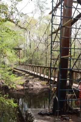
Town of Leno suspension bridge image. Click for full size.
Photographed By Mike Stroud, March 20, 2013
3. Town of Leno suspension bridge
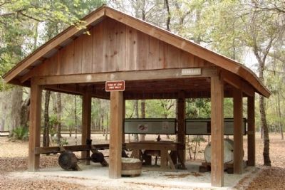
Town of Leno Grist Mills, as mentioned image. Click for full size.
Photographed By Mike Stroud, March 20, 2013
4. Town of Leno Grist Mills, as mentioned
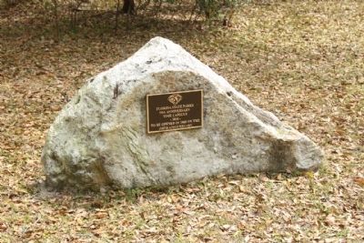
Town of Leno image. Click for full size.
Photographed By Mike Stroud, March 20, 2013
5. Town of Leno
Florida State Parks 75th Anniversary Time Capsule -2010- To Be Opened in 2085 on the 150th Anniversary
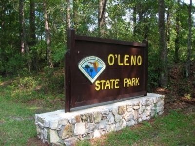
O' Leno State Park image. Click for full size.
Photographed By Julie Szabo, August 12, 2007
6. O' Leno State Park
 
 
Credits. This page was last revised on July 31, 2017. It was originally submitted on April 2, 2013, by Mike Stroud of Bluffton, South Carolina. This page has been viewed 909 times since then and 72 times this year. Photos:   1, 2, 3, 4, 5. submitted on April 2, 2013, by Mike Stroud of Bluffton, South Carolina.   6. submitted on October 31, 2007, by Julie Szabo of Oldsmar, Florida.
Share this page.  
Share on Tumblr
m=64075

CeraNet Cloud Computing sponsors the Historical Marker Database.
This website earns income from purchases you make after using our links to Amazon.com. We appreciate your support.
Paid Advertisement
May. 9, 2024