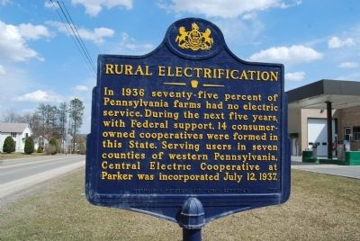
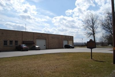
Near Parker in Clarion County, Pennsylvania — The American Northeast (Mid-Atlantic)
Rural Electrification
Erected 1987 by Pennsylvania Historical and Museum Commission.
Topics and series. This historical marker is listed in this topic list: Industry & Commerce. In addition, it is included in the Pennsylvania Historical and Museum Commission, and the Rural Electrification 💡 series lists. A significant historical date for this entry is July 12, 1831.
Location. 41° 6.06′ N, 79° 39.888′ W. Marker is near Parker, Pennsylvania, in Clarion County. Marker is on Pennsylvania Route 368 east of Terwilliger Road (Local Road 871), on the right when traveling east. Located at the Central Electric Co-op east of Parker. Touch for map. Marker is in this post office area: Parker PA 16049, United States of America. Touch for directions.
Other nearby markers. At least 8 other markers are within 6 miles of this marker, measured as the crow flies. Parker's Landing Petroglyphs (approx. 0.4 miles away); Parker, Pennsylvania (approx. 0.9 miles away); Erie to Pittsburgh Trail (approx. 2.7 miles away); Foxburg (approx. 2.7 miles away); F.H. Ball Steam Engine (approx. 2.8 miles away); Foxburg Golf Course (approx. 3.2 miles away); Foxburg Country Club (approx. 3˝ miles away); The Emlenton Mill (approx. 5.7 miles away). Touch for a list and map of all markers in Parker.
Credits. This page was last revised on July 22, 2021. It was originally submitted on April 7, 2013, by Mike Wintermantel of Pittsburgh, Pennsylvania. This page has been viewed 705 times since then and 13 times this year. Photos: 1, 2. submitted on April 7, 2013, by Mike Wintermantel of Pittsburgh, Pennsylvania.

