Southbury in New Haven County, Connecticut — The American Northeast (New England)
Where Rochambeau Crossed the Housatonic River
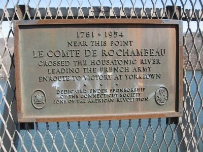
1781 * 1954
Inscription.
Le Comte de Rochambeau
crossed the Housatonic River
leading the French Army
enroute to victory at Yorktown.
Erected 1954 by Connecticut Society Sons of the American Revolution.
Topics and series. This historical marker is listed in this topic list: War, US Revolutionary. In addition, it is included in the Sons of the American Revolution (SAR), and the The Washington-Rochambeau Route series lists.
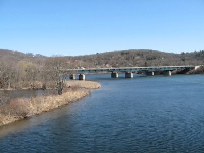
Location. 41° 26.348′ N, 73° 14.844′ W. Marker is in Southbury, Connecticut, in New Haven County. Marker is on Interstate 84 (Interstate 84), on the right when traveling east. Marker is on the Rochambeau Bridge where I-84 crosses the Housatonic River. Touch for map. Marker is in this post office area: Southbury CT 06488, United States of America. Touch for directions.
Other nearby markers. At least 8 other markers are within 4 miles of this marker, measured as the crow flies. Russian Village (approx. 0.7 miles away); South Britain Congregational Church (approx. 2.2 miles away); Southbury Stops Nazi Training Camp (approx. 2.2 miles away); Southbury World War II Memorial (approx. 2.3 miles away); Southbury World War I Memorial (approx. 2.3 miles away); Southbury Veterans Memorial (approx. 2.3 miles away); Southbury (approx. 2.4 miles away); In Commemoration (approx. 3.3 miles away). Touch for a list and map of all markers in Southbury.
More about this marker. Marker is located on the pedestrian walkway fence on the southern bridge (East-bound). It is at the mid-point, between Southbury, New Haven County and Newtown, Fairfield County.
Credits. This page was last revised on February 11, 2023. It was originally submitted on March 21, 2008, by Michael Herrick of Southbury, Connecticut. This page has been viewed 4,256 times since then and 54 times this year. Photos: 1, 2. submitted on March 21, 2008, by Michael Herrick of Southbury, Connecticut. • J. J. Prats was the editor who published this page.

