Walnut Creek in Lenoir County, North Carolina — The American South (South Atlantic)
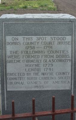
Dobbs County Court House
Dobbs County Court House
1758-1791
The following counties
were formed from Dobbs.
Greene (formerly Glascow) 1779
Wayne 1779
Lenoir 1791
Erected by the Wayne County
Committee North Carolina Society
Colonial Dames Of America
1935
Topics. This historical marker is listed in this topic list: Settlements & Settlers. A significant historical year for this entry is 1779.
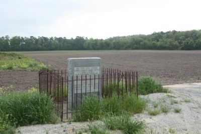
Location. 35° 17.112′ N, 77° 51.893′ W. Marker is in Walnut Creek, North Carolina, in Lenoir County. Marker is on Dobbs County Court House Road. Touch for map. Marker is in this post office area: La Grange NC 28551, United States of America. Touch for directions.
Other nearby markers. At least 8 other markers are within 10 miles of this marker, measured as the crow flies. A different marker also named Dobbs County Court House (approx. 2.3 miles away); Dobbs County (approx. 2.4 miles away); Engagement at Whitehall (approx. 4.1 miles away); The Battle of Whitehall (approx. 4.1 miles away); William Dunn Moseley (approx. 4.3 miles away); James Y. Joyner (approx. 4˝ miles away); Seymour Johnson Air Force Base (approx. 7.7 miles away); Odd Fellows Home (approx. 9.4 miles away). Touch for a list and map of all markers in Walnut Creek.
Related marker. Click here for another marker that is related to this marker. .. see the relationship marker shown.
Also see . . . Dobbs County Court House. in 1758, Dobbs County was formed from Johnston. The order annexing Dobbs, the state historical department's book states, is as follows: "...That from & after the Tenth day of April next the said county be divided by the dividing line between the Parish of St. Patrick & the Parish of St. Stephen; & that part of the said county which is now the Parish of St. Stephen, remain, be called & known by the name of Johnston; & that part of the said county which is the Parish of St. Patrick, be thenceforth erected into a distinct county & called & known by the name of Dobbs." (Submitted on April 30, 2013, by Mike Stroud of Bluffton, South Carolina.)
Credits. This page was last revised on June 16, 2016. It was originally submitted on April 26, 2013, by Mike Stroud of Bluffton, South Carolina. This page has been viewed 660 times since then and 44 times this year. Photos: 1, 2. submitted on April 30, 2013, by Mike Stroud of Bluffton, South Carolina.

