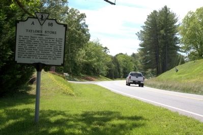
Near Gills Creek in Franklin County, Virginia — The American South (Mid-Atlantic)
Taylorís Store
Erected 1989 by Department of Historic Resources. (Marker Number A-98.)
Topics. This historical marker is listed in these topic lists: Communications • Industry & Commerce • Settlements & Settlers • War, US Revolutionary. A significant historical year for this entry is 1799.
Location. 37° 7.089′ N, 79° 47.545′ W. Marker is near Gills Creek, Virginia, in Franklin County. Marker is on Booker T. Washington Highway (Virginia Route 122) just west of Inglewood Road (Route 672), on the left when traveling west. Touch for map. Marker is in this post office area: Wirtz VA 24184, United States of America. Touch for directions.
Other nearby markers. At least 8 other markers are within 4 miles of this marker, measured as the crow flies. Booker T. Washington National Monument (approx. 3.4 miles away); Booker T. Washington's Birthplace (approx. 3.4 miles away); Slavery on the Plantation (approx. 3.4 miles away); Booker T. Washington Birthplace (approx. 3.4 miles away); How Tobacco Farms Used Slavery (approx. 3.4 miles away); Freed Here, At Last (approx. 3.4 miles away); Jack-O-Lantern Branch Trail (approx. 3.4 miles away); I think that I owe a great deal of my present strength and ability to work to my love of... (approx. 3Ĺ miles away).
Credits. This page was last revised on December 25, 2019. It was originally submitted on May 30, 2013, by J. J. Prats of Powell, Ohio. This page has been viewed 1,191 times since then and 133 times this year. Photos: 1, 2. submitted on May 30, 2013, by J. J. Prats of Powell, Ohio.

