Galax, Virginia — The American South (Mid-Atlantic)
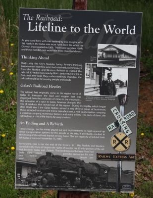
The Railroad: Lifeline to the World
Thinking Ahead. That’s why the City’s founders, being forward-thinking businessmen that they were, had obtained a commitment from the Norfolk and Western Railway to extend the railroad 2.7 miles from nearby Blair—before the first lot in Galax was ever sold. They understood how important the railroad would be for moving people and goods.
Galax’s Railroad Heyday. The railroad had originally come to the region north of Galax to transport the lead and copper that was disgorged from the profusion of mines in the mountains. The extension of a spur to Galax, however, changed the mix of products that moved out of the region. During its heyday, which began after World War I, the Galax Station served a very diverse group of businesses. These included furniture and mirror manufacturers, a milk condensation company, a weaving company, numerous farmers, and many others. For each of them, the railroad was a critical life-line to far away markets.
An Ending and A Rebirth. Times change. As the mines played out and improvements in roads opened up other transportation options for the people in the area, it eventually resulted in the closing of the railroad branch serving Galax. The last regularly scheduled train left Galax at noon on November 15, 1985.
Fortunately, that is not the end of the history. In 1986, Norfolk and Western donated to the State of Virginia the rights-of-way for the 57-mile portion of the rail bed between Galax and Pulaski. That land became the New River Trail State Park, which provides recreation for over one million people per year!
Topics. This historical marker is listed in these topic lists: Industry & Commerce • Railroads & Streetcars. A significant historical month for this entry is November 1904.
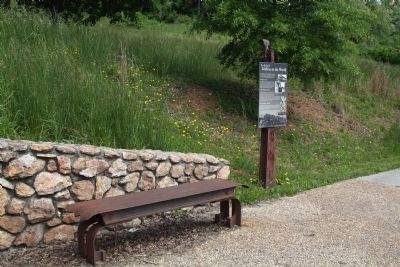
Location. 36° 39.995′ N, 80° 55.6′ W. Marker is in Galax, Virginia. Marker is at the intersection of East Stuart Drive (U.S. 211) and North Main Street (Virginia Route 89), on the right when traveling west on East Stuart Drive. Touch for map. Marker is in this post office area: Galax VA 24333, United States of America. Touch for directions.
Other nearby markers. At least 8 other markers are within 5 miles of this marker, measured as the crow flies. Carroll County / Grayson County (about 600 feet away, measured in a direct line); Galax (approx. 0.2 miles away); Galax: Home of Traditional Mountain Music (approx. 0.2 miles away); a different marker also named Galax (approx. 0.7 miles away); Old County Seat (approx. 2.1 miles away); Fries (approx. 2.3 miles away); “New River Train” Song (approx. 4.6 miles away); a different marker also named Fries (approx. 4.6 miles away). Touch for a list and map of all markers in Galax.
Also see . . . 1906–1956 Golden Anniversary of Galax, Virginia. History of Galax as of 1956 by Frank M. Heaster. Excerpt: “This rural condition remained until the Railway extended into this community. The N&W Railway had decided to extend the branch line from the main line at Pulaski, Virginia, up New River and Chestnut Creek and on across the mountain to connect with the Railway at Mt. Airy, N.C., so as to give them a more direct route from the coal fields to the South, but they had only succeeded in getting trains running as far as Chestnut Yards when they secured a lease on the line from Roanoke to Winston-Salem that gave them the southern outlet, when they then abandoned the [completion] of this branch line.” (Submitted on June 3, 2013.)
Credits. This page was last revised on April 16, 2017. It was originally submitted on June 3, 2013, by J. J. Prats of Powell, Ohio. This page has been viewed 738 times since then and 54 times this year. Photos: 1, 2. submitted on June 3, 2013, by J. J. Prats of Powell, Ohio.

