Near La Porte in Plumas County, California — The American West (Pacific Coastal)
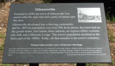
Gibsonville
Gibsonville developed into a thriving community, and by 1855 its population was over 700. In its prime, the town had six dry goods stores, four hotels, three saloons, an express office, community hall, and a Masonic Lodge. The town’s population declined in the later part of the 1800’s. Today, all that remains is the town’s cemetery.
Please help protect your American Heritage
On lands administered by the Forest Service, it is unlawful to excavate, remove, disturb, deface, or destroy any historic building, ruin, site, artifact, or object, or to collect, appropriate, excavate, damage, disturb, or destroy historic artifacts. Violators are subject to arrest. Conviction can carry criminal penalties of up to two years in prison and/or $500,000 in fines. ... Archaelogical (sic) Resources Protection Act of 1979
Erected by Plumas National Forest Service.
Topics. This historical marker is listed in this topic list: Settlements & Settlers. A significant historical year for this entry is 1850.
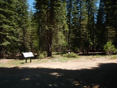
Location. 39° 44.435′ N, 120° 54.603′ W. Marker is near La Porte, California, in Plumas County. Marker is on Forest Service Road 900, on the right when traveling south. Forest Service Road 900 is approximately 7 miles east of La Porte on the Quincy - La Port Road. Touch for map. Marker is in this post office area: Strawberry Valley CA 95981, United States of America. Touch for directions.
Other nearby markers. At least 8 other markers are within 6 miles of this marker, measured as the crow flies. La Porte – Quincy Wagon Road (approx. 4.1 miles away); Round Lake Mine (approx. 5.1 miles away); Reilly’s Saloon (approx. 5½ miles away); Fuller & Buell (approx. 5.6 miles away); La Porte’s Chinese Community (approx. 5.6 miles away); Frank D. Everts (approx. 5.6 miles away); Cleve O’Rourke Memorial Stampmill (approx. 5.6 miles away); John Conly & Co. Bankers (approx. 5.6 miles away). Touch for a list and map of all markers in La Porte.
Credits. This page was last revised on June 16, 2016. It was originally submitted on June 12, 2013, by Barry Swackhamer of Brentwood, California. This page has been viewed 589 times since then and 20 times this year. Photos: 1, 2. submitted on June 12, 2013, by Barry Swackhamer of Brentwood, California. • Syd Whittle was the editor who published this page.
Editor’s want-list for this marker. Photo of the cemetery. • Can you help?

