Near Coleman in Sumter County, Florida — The American South (South Atlantic)
Adamsville
Historic Marker
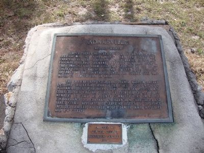
The officers appointed by governor Madison S. Perry included D.G. Leigh, Clerk of the Circuit Court, Wilson C. Williams, Judge of Probate, Solomon Hall, Tax Assessor and Collector, J.S. Kilgore, County Surveyor, E.H. Crow, Sheriff. Members to serve as county commissioners included, F.W. Durrance, D.B. Chapman, L.B. Branch, W. Carruthers, and James Weeks. Appointed to serve as justices of the peace included J.A. Lee, J.G. Hall, Moses Daniel, James A. Collins, and R.W. Giskins.
Erected 1982 by Sumter County Historical Society.
Topics. This historical marker is listed in this topic list: Settlements & Settlers. A significant historical month for this entry is January 1813.
Location. 28° 47.976′ N, 82° 1.383′ W. Marker is near Coleman, Florida, in Sumter County. Marker is on County Road 468, 2 miles east of U.S. 301, on the right when traveling east. Touch for map. Marker is in this post office area: Coleman FL 33521, United States of America. Touch for directions.
Other nearby markers. At least 8 other markers are within 9 miles of this marker, measured as the crow flies. Baker House (approx. 2.9 miles away); Bank of Wildwood (approx. 4˝ miles away); Sumterville (approx. 4.6 miles away); Oak Grove Cemetery Confederate Veterans Memorial (approx. 5.9 miles away); The Casino (approx. 7.8 miles away); Veterans of All Wars (approx. 7.8 miles away); Royal School Site (approx. 7.9 miles away); Holy Trinity Episcopal Church (approx. 8.3 miles away).
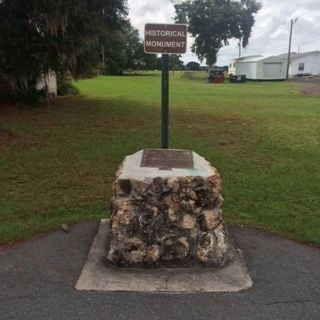
More about this marker. Located in front of the Adamsville Community Cemetery.
Credits. This page was last revised on July 22, 2018. It was originally submitted on July 19, 2013, by Tim Fillmon of Webster, Florida. This page has been viewed 994 times since then and 71 times this year. Photos: 1. submitted on July 19, 2013, by Tim Fillmon of Webster, Florida. 2. submitted on September 27, 2014, by James R. Murray of Elkton, Florida. • Bill Pfingsten was the editor who published this page.

