Rock Springs in Sweetwater County, Wyoming — The American West (Mountains)
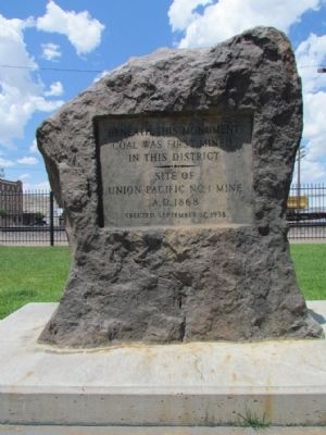
Beneath This Monument
Coal Was First Mined
In This District
Site Of
Union Pacific No. 1 Mine
A.D. 1868
Erected September 17, 1938
Erected 1938.
Topics. This historical marker and monument is listed in this topic list: Industry & Commerce. A significant historical date for this entry is September 17, 1850.
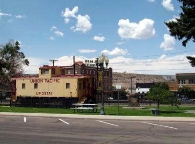
Location. 41° 35.19′ N, 109° 13.248′ W. Marker is in Rock Springs, Wyoming, in Sweetwater County. Marker is on S. Main Street east of C Street, on the right when traveling west. Marker is located in Railroad Park between the Rock Springs Coal Welcome sign and the railroad depot building. Touch for map. Marker is in this post office area: Rock Springs WY 82901, United States of America. Touch for directions.
Other nearby markers. At least 8 other markers are within 6 miles of this marker, measured as the crow flies. A Tragedy Remembered (within shouting distance of this marker); Rock Springs Coal Welcome Sign (within shouting distance of this marker); "Charlie Smith" (within shouting distance of this marker); Rock Springs Coal (within shouting distance of this marker); Rock Spring Stage Station Site (approx. 1.3 miles away); Oil Derrick (approx. 1.6 miles away); Tipples and the Reliance Coal Mines (approx. 5.8 miles away); The Reliance Tipple (approx. 5.8 miles away). Touch for a list and map of all markers in Rock Springs.
Credits. This page was last revised on June 16, 2016. It was originally submitted on August 17, 2013, by Duane Hall of Abilene, Texas. This page has been viewed 545 times since then and 14 times this year. Photos: 1, 2, 3. submitted on August 17, 2013, by Duane Hall of Abilene, Texas.


