Near Wamsutter in Sweetwater County, Wyoming — The American West (Mountains)
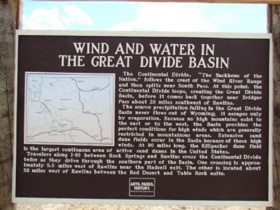
Wind and Water in the Great Divide Basin
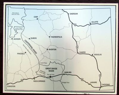
The Continental Divide, "The Backbone of the Nation," follows the crest of the Wind River Range and then splits near South Pass. At this point, the Continental Divide loops, creating the Great Divide Basin, before it comes back together near Bridger Pass about 20 miles southwest of Rawlins.
The scarce precipitation falling in the Great Divide Basin never flows out of Wyoming; it escapes only by evaporation. Because no high mountains exist to the east or to the west, the Basin provides the perfect conditions for high winds which are generally restricted in the mountainous areas. Extensive sand dune fields occur in the Basin because of these high winds. At 90 miles long, the Killpecker dune field is the largest continuous area of active sand dunes in the United States.
Travelers along I-80 between Rock Springs and Rawlins cross the Continental Divide twice as they drive through the southern part of the Basin. One crossing is approximately 5.5 miles west of Rawlins near the Hadsell exit. The other is located about 58 miles west of Rawlins between the Red Desert and Table Rock exits.
Erected by Wyoming State Parks & Cultural Resources.
Topics. This historical marker is listed in this topic list: Notable Places.
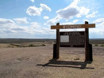
Location. 41° 42.791′ N, 107° 47.113′ W. Marker is near Wamsutter, Wyoming, in Sweetwater County. Marker can be reached from Interstate 80 at milepost 184, on the right when traveling east. To reach marker, after exiting I-80 at Exit 184 (Continental Divide Road), drive south for less than 1/8 mile till you reach a wide gravel/dirt road (this is the roadbed of the Lincoln Highway). Turn left (west) on road and in approx. 0.2 miles you will see marker on your left. You can park on the Lincoln Highway roadbed and walk to the marker, or continue driving a little past the marker and you will find on your left a one-lane dirt road that leads to the marker. Touch for map. Marker is in this post office area: Wamsutter WY 82336, United States of America. Touch for directions.
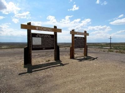
Other nearby markers. At least 1 other marker is within walking distance of this marker. Henry Bourne Joy and the Lincoln Highway (here, next to this marker).
Credits. This page was last revised on September 4, 2020. It was originally submitted on August 21, 2013, by Duane Hall of Abilene, Texas. This page has been viewed 897 times since then and 35 times this year. Photos: 1, 2, 3, 4. submitted on August 21, 2013, by Duane Hall of Abilene, Texas.


