St. Joseph in Berrien County, Michigan — The American Midwest (Great Lakes)
St. Joseph River Swing Bridge
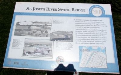
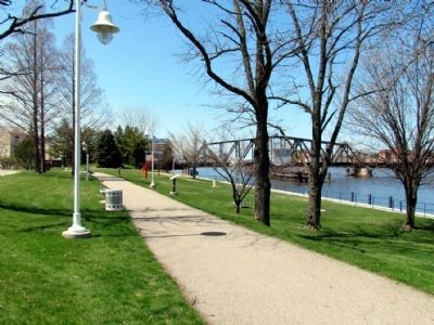
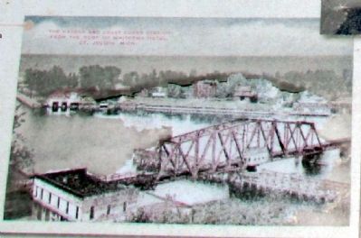
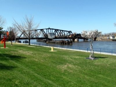
Three swing bridges have crossed the St. Joseph River at this location. The first swing bridge opened in 1870 when the Chicago & Michigan Lake Shore Railroad expanded. The second bridge was built by the Chicago & West Michigan Railroad in 1887. The Pere Marquette Railroad commissioned the present bridge, which was completed in 1904. The bridge is owned and maintained by CSX (Chessie and Seaboard Expanded) Transportation.
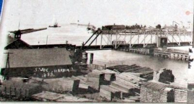
(Upper Left Photo Caption)
The 1887 bridge was replaced after sixteen years when it proved too light for newer locomotives.
Photo: The Heritage Museum and Cultural Center
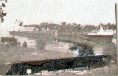
(Upper Right Photo Caption)
During the boating season, a bridge attendant is on duty 24 hours a day to allow passage for boats and freighters, such as the SAM LAUD, shown above circa 1995. In winter, the bridge is unmanned and locked to accommodate trains.
Photo: The Heritage Museum and Cultural Center
(Lower Photo Caption)
Due to its well-balanced construction, the 231-foot, 300-ton bridge can be turned with a single 10-horsepower electric motor. It takes approximately 42 seconds to open.
Postcard (circa 1925): The Heritage Museum and Cultural Center
Erected by City of St. Joseph, The Heritage Museum and Cultural Center, and the Public History Program at Western Michigan University.
Topics. This historical marker is listed in these topic lists: Bridges & Viaducts • Railroads & Streetcars. A significant historical year for this entry is 1870.
Location. 42° 6.707′ N, 86° 28.89′ W. Marker is in St. Joseph, Michigan, in Berrien County. Marker is on Water Street west of State Street, on the right when traveling west. Touch for map. Marker is in this post office area: Saint Joseph MI 49085, United States of America. Touch for directions.
Other nearby markers. At least 8 other markers are within walking distance of this marker. Commercial Fishing (within shouting distance of this marker); Creating a Harbor (within shouting distance of this marker); St. Joseph's Firemen (within shouting distance of this marker); U.S. Lighthouse Supply Depot (within shouting distance of this marker); Commercial Shipping (about 300 feet away, measured in a direct line); Recreational Boating (about 300 feet away); Shipbuilding in the Twin Cities (about 400 feet away); St. Joseph Maritime Heritage (about 400 feet away). Touch for a list and map of all markers in St. Joseph.
More about this marker. The marker is the eleventh of 12 interpretive signs along the St. Joseph Maritime Heritage Trail.
Related markers. Click here for a list of markers that are related to this marker. These are the markers of the St. Joseph Maritime Heritage Trail. To study the markers in their order along the trail, read each marker in the order shown.
Also see . . . St. Joseph Railroad Bridge - historicbridges.org. (Submitted on August 30, 2013, by Duane Hall of Abilene, Texas.)
Credits. This page was last revised on June 16, 2016. It was originally submitted on August 30, 2013, by Duane Hall of Abilene, Texas. This page has been viewed 1,067 times since then and 62 times this year. Photos: 1, 2, 3, 4, 5, 6. submitted on August 30, 2013, by Duane Hall of Abilene, Texas.
