Seaside in Monterey County, California — The American West (Pacific Coastal)
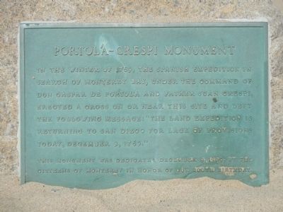
Portola-Crespi Monument
This monument was dedicated December 9, 1969, by the
Citizens of Monterey in honor of our 200th birthday.
Erected 1969 by Citzens of Monterey.
Topics and series. This historical marker and monument is listed in this topic list: Exploration. In addition, it is included in the Portolá Expedition series list. A significant historical date for this entry is December 9, 1213.
Location. 36° 36.581′ N, 121° 51.618′ W. Marker is in Seaside, California, in Monterey County. Marker can be reached from Sand Dunes Drive. Touch for map. Marker is at or near this postal address: 2600 Sand Dunes Drive, Seaside CA 93955, United States of America. Touch for directions.
Other nearby markers. At least 8 other markers are within 2 miles of this marker, measured as the crow flies. 9/11 Memorial (approx. one mile away); Depots (approx. one mile away); Herrmann Hall (approx. 1.2 miles away); Commodore John Drake Sloat Circle (approx. 1.2 miles away); Rear Admiral Alan Shepard Tree (approx. 1.2 miles away); Hotel del Monte Historic District (approx. 1.2 miles away); Admiral Raymond A. Spruance Plaza (approx. 1.3 miles away); Ingersoll Memorial (approx. 1.3 miles away).
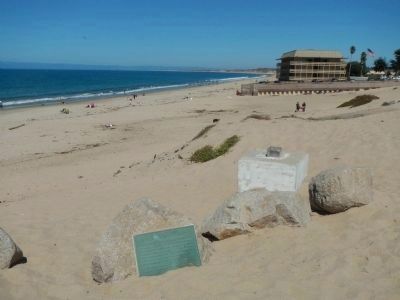
More about this monument. To find this marker, take the Monterey Peninsula Recreation Trail from the Houghton M. Roberts Beach parking lot (located at the south end of Sand Dunes Drive). The marker is located next to the base of the cross, overlooking the beach.
Regarding Portola-Crespi Monument. The cross was cut down by vandals on September 19, 2009.
Also see . . .
1. Portolá-Crespi Cross Monument. Photograph of the cross before it was cut down by vandals. (Submitted on September 28, 2013, by Barry Swackhamer of Brentwood, California.)
2. Portola’s real landing place – Pacific Grove -- Monterey County Weekly. The latest problem with reinstalling the 1969 Portola-Crespi Cross on Del Monte Beach is not a problem of separating church from state, but rather a problem of separating fact from fiction. There is compelling historical evidence that the city of Monterey is likely fighting the wrong battle, in the wrong place. (Submitted on September 28, 2013, by Barry Swackhamer of Brentwood, California.)
Credits. This page was last revised on June 16, 2016. It was originally submitted on September 28, 2013, by Barry Swackhamer of Brentwood, California. This page has been viewed 888 times since then and 60 times this year. Photos: 1, 2. submitted on September 28, 2013, by Barry Swackhamer of Brentwood, California. • Syd Whittle was the editor who published this page.

