Anchorage, Alaska — Northwest (North America)
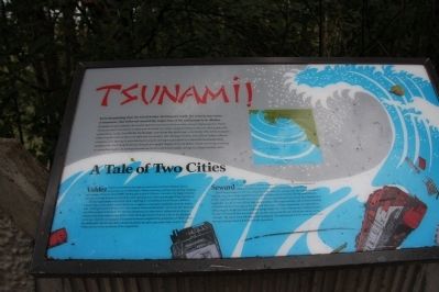
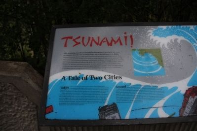
Tsunami!
Tsunamis are generated by the sudden upward movement of the seafloor along the rupturing fault. These waves can travel thousands of miles and can strike low-lying coastal areas hours after an earthquake with violent force. In the Good Friday Earthquake, some areas like Anchorage were barely affected by tsunamis. Other coastal communities with different topography, like Chenega, Kodiak, Seward and Valdez suffered complete ruin. Sharing in grim destructive power are waves generated by submarine landslides along coastal areas where huge volumes of water are rapidly displaced by soil debris. These waves occur during or immediately after an earthquake and can be 30 to 50 feet in height, as high as a large tsunami wave
Valdez Valdez was nestled at the head of a scenic fjord in Prince William Sound. A thriving city of 1200 people, Valdez’s economy was based on fishing, shipping and tourism. When the Good Friday Earthquake struck at 5:36 p.m., the entire city began violently heaving, and huge fissures formed in the earth spewing mud, water and sewage 20 feet into the air.
Twenty-eight people were on the dock, watching the unloading of the SS Chena, a 400 foot Liberty Ship. As the quake reached full force, it triggered a submarine landslide under the harbor area, which generated a 40 foot wave which instantaneously destroyed the harbor, the docks, the canneries, and all the people on the dock. The SS Chena bottomed out three times, rolling in pitching so violently that three seamen were killed. When the huge wave retreated, it threw the SS Chena out to sea, relatively undamaged. Successive tsunamis completed the destruction of Valdez. After the earthquake, the city decided to move to a seismically safer area rather than rebuild. Today Valdez sits four miles northwest of the original site.
Seward A fortunate town, Seward was one of the few ice free ports in Southcentral Alaska, and had an active economy in fishing and industry all year. Everything changed at 5:36 p.m., March 27, 1964. Forty-five seconds after the earthquake started shaking, huge slices of the Seward waterfront and harbor slid into the bay. The Standard Oil dock facility ruptured, spewing fuel everywhere. As the Standard Oil tanks overturned, they exploded and caught fire. A wall of water 30 feet high, generated by a submarine landslide, and covered in burning oil, swallowed the remaining harbor and dock area. Forty oil-filled railroad tank cars exploded in a chain reaction. As the first wave subsided, people made their way to high ground, fearing tsunamis. Twenty-five minutes after the earthquake, the first tsunami hit Seward with 40 foot waves moving 100 mph. The waves were still ablaze with burning oil. The last tsunami left the town 10 hours later leaving 13 people dead and Seward totally devastated.
Topics. This historical marker is listed in this topic list: Disasters. A significant historical date for this entry is March 27, 1964.
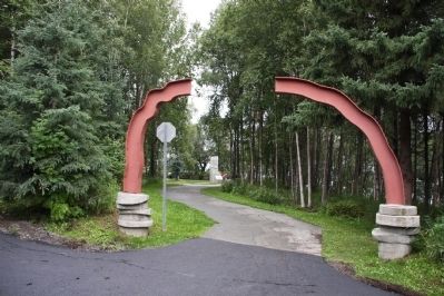
Location. 61° 11.898′ N, 149° 58.751′ W. Marker is in Anchorage, Alaska. This marker is located in Earthquake Park on W Northern Lights Blvd. It is also accessible from the Tony Knowles Bicycle Trail. Parking is available on W Northern Lights Blvd. (N 61° 11.756 W 149° 58.578). From the parking lot, follow the paved path to the marker. Touch for map. Marker is in this post office area: Anchorage AK 99502, United States of America. Touch for directions.
Other nearby markers. At least 8 other markers are within 5 miles of this marker, measured as the crow flies. Turnagain Heights Slide (within shouting distance of this marker); The Earth Did Quake (within shouting distance of this marker); Measuring the Magnitude of Damage (within shouting distance of this marker); Anchorage Aloft! (within shouting distance of this marker); Oscar Gill House (approx. 2˝ miles away); Resolution Park 1776 / 1778 (approx. 2.9 miles away); Captain James Cook (approx. 2.9 miles away); What is this “Rock Man”? (approx. 4.3 miles away). Touch for a list and map of all markers in Anchorage.
Also see . . .
1. Great Alaskan earthquake of 1964. Source: You Tube video (Submitted on October 8, 2013, by Byron Hooks of Sandy Springs, Georgia.)
2. 1964 Alaska earthquake. Source: Wikipedia (Submitted on October 8, 2013, by Byron Hooks of Sandy Springs, Georgia.)
3. Tsunamis. Source: Wikipedia (Submitted on October 8, 2013, by Byron Hooks of Sandy Springs, Georgia.)
Credits. This page was last revised on August 29, 2020. It was originally submitted on October 8, 2013, by Byron Hooks of Sandy Springs, Georgia. This page has been viewed 1,388 times since then and 95 times this year. Last updated on October 27, 2013, by Byron Hooks of Sandy Springs, Georgia. Photos: 1, 2, 3. submitted on October 8, 2013, by Byron Hooks of Sandy Springs, Georgia. • Syd Whittle was the editor who published this page.


