Near Yreka in Siskiyou County, California — The American West (Pacific Coastal)
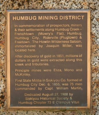
Humbug Mining District
After discovery of gold in 1851, million of dollars in gold were extracted along this creek and tributaries.
Principle mines were Eliza, Mono and McKinley.
First State Militia in Siskiyou Co. formed at Humbug City Dec. 6, 1855, was 75 men commanded by Capt. William Martin.
Siskiyou Historical Society &
Humbug Chapter 73 E Clampus Vitus
Erected 1988 by E Clampus Vitus, Humbug Chapter 73 & Siskiyou County Historical Society.
Topics and series. This historical marker is listed in this topic list: Settlements & Settlers. In addition, it is included in the E Clampus Vitus series list. A significant historical month for this entry is December 1793.
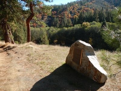
Location. 41° 47.249′ N, 122° 42.061′ W. Marker is near Yreka, California, in Siskiyou County. Marker is on Humbug Creek Road, on the left when traveling west. Touch for map. Marker is in this post office area: Yreka CA 96097, United States of America. Touch for directions.
Other nearby markers. At least 8 other markers are within 5 miles of this marker, measured as the crow flies. Frogtown (approx. 4.4 miles away); Yreka Trail – A Mighty Town (approx. 4˝ miles away); Thompson’s Dry Diggings (approx. 4˝ miles away); Siskiyou County High School (approx. 4.8 miles away); First Log House (approx. 4.8 miles away); Carnegie Library Building (approx. 5 miles away); Chamberlain-Stimmel Building (approx. 5 miles away); Peters & DeWitt Building (approx. 5 miles away). Touch for a list and map of all markers in Yreka.
More about this marker. This marker is on Humbug Creek Road, approximately 6 1/2 miles from CA Highway 263 via the Hawkinsville Humbug Road.
Also see . . . Humbug District - Westerm Mining History. Humbug is in north-central Siskiyou County about 10 miles northwest of Yreka. Humbug Creek, which /lows into the upper Klamath River, was extremely rich during the early days; it is credited with an output of nearly $15 million. (Submitted on November 14, 2013, by Barry Swackhamer of Brentwood, California.)
Credits. This page was last revised on June 16, 2016. It was originally submitted on November 14, 2013, by Barry Swackhamer of Brentwood, California. This page has been viewed 734 times since then and 39 times this year. Photos: 1, 2, 3. submitted on November 14, 2013, by Barry Swackhamer of Brentwood, California. • Al Wolf was the editor who published this page.


