Smithfield in Johnston County, North Carolina — The American South (South Atlantic)
The Town of Smithfield
Riverwalk Gives Founder's Commons New Life
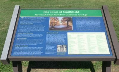
Neuse River Ferry Landing
In 1759 Smith petitioned to operate a ferry where the Neuse River cut through the land he owned. The site became known as Smith’s Ferry. In 1762, Smith’s son, John Smith, Jr. purchased 228 acres of his father’s tract, including the ferry. The younger Smith was 26 years old. In 1771, Smith and his wife took up residency on the land, building a home on a rise overlooking the river and the ferry. The home became a public house, providing overnight accommodations for travelers.
Johnston County Courthouse
Also in 1771, construction began on Johnston County’s third courthouse not far from Smith’s residence, and soon the name Smith’s Ferry was replaced by Johnston County Courthouse.
Town of Smithfield
The town of Smithfield came in to being with the inaugural session of the General Assembly of the newly proclaimed State of North Carolina in 1777. Smith, Jr. had agreed to provide 100 acres for the town and an additional 50 acres for a “common” along the Neuse River south and west of his riverside home.
Bridge Over the Neuse
Eventually, a bridge was built across the Neuse River, eliminating the need for Smith’s Ferry. This bridge was burned during the Civil War to hinder the Northern army in its march through the county. The bridge was rebuilt after the Civil War by J. Bryant Alford and used until the early 1900s. Mr. Alford was a free black during slavery and Johnston County’s first African-American merchant. He opened a saw mill, cotton gin and a store here.
The Neuse Riverwalk
Although the town’s 1777 charter set aside the land along the Neuse River as a commons, it wasn’t utilized as a park until nearly 200 years later. The Neuse Riverwalk, the trail stretching from the Girl Scout Hut at Second Street to the boat ramp at Bridge Street, was first conceptualized by Smithfield’s Year-Round Garden Club and was called the Neuse River Nature Trail. The trail opened in 1972, and improvements to it were made by the town’s Appearance Commission, Public Works Department and Parks and Recreation Department in conjunction with Smithfield’s Bicentennial celebration in 1977.
Improving the Riverwalk
In 1999, the Downtown Smithfield Development Corporation recognized the need for future improvements to the riverwalk and started a capital campaign to raise the money needed. The corporation commissioned and original painting of the colonial-era ferry landing on the Neuse River. Numbered prints signed by the artist, Renee K. Langdon, were sold to raise funds for the Riverwalk. Since 1999, these and other funds have been utilized to improve the Neuse Riverwalk by paving the trail and adding lighting. The riverwalk became part of the Buffalo Creek Greenway when it was completed in November 2009. The greenway is part of North Carolina’s Mountains-to-Sea Trail, which extends from Clingman’s Dome in the Great Smoky Mountains National Park to Jockey’s Ridge State Park.
(captions)
(upper center)Smith's Ferry by artist Renee K. Langdon
(lower center) A 1970s photo of Year-Round Garden Club members (left to right) Mattie Lassiter, Josephine George, and Ruth Booker
Topics. This historical marker is listed in this topic list: Settlements & Settlers. A significant historical month for this entry is November 2009.
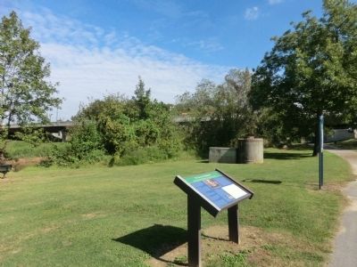
Location. 35° 30.73′ N, 78° 20.991′ W. Marker is in Smithfield, North Carolina, in Johnston County. Marker can be reached from South Front Street south of East Market Street (Business U.S. 70), on the right when traveling south. Located along the Smithfield Neuse Riverwalk. Touch for map. Marker is at or near this postal address: 104 South Front Street, Smithfield NC 27577, United States of America. Touch for directions.
Other nearby markers. At least 8 other markers are within walking distance of this marker. Edward W. Pou (within shouting distance of this marker); a different marker also named Town of Smithfield (about 300 feet away, measured in a direct line); Hastings House (about 300 feet away); Occupation of Smithfield (about 800 feet away); Sherman Receives News of Lee's Surrender in Smithfield (approx. 0.2 miles away); Freedmen’s School, 1868 (approx. 0.4 miles away); Ava Gardner (approx. 0.6 miles away); Sherman’s March (approx. 0.8 miles away). Touch for a list and map of all markers in Smithfield.
Credits. This page was last revised on June 16, 2016. It was originally submitted on November 24, 2013, by Don Morfe of Baltimore, Maryland. This page has been viewed 1,166 times since then and 103 times this year. Photos: 1, 2. submitted on November 24, 2013, by Don Morfe of Baltimore, Maryland. • Bernard Fisher was the editor who published this page.

