Chatham in Chatham-Kent, Ontario — Central Canada (North America)
Chatham Armoury
100th Anniversary
— 1905-2005 —
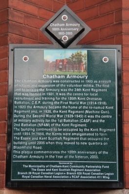
The Chatham Armoury was constructed in 1905 as a result of reform and expansion of the volunteer militia. The first unit to occupy the Armoury was the 24th Kent Regiment that was formed in 1901. It was the centre for local recruitment and training for the 186th Kent Overseas Battalion, CE.F. during the First World War, 1914-1918. In 1920 the Armoury became the home of the renamed Kent Regiment and, in 1936, the Kent Regiment, Machine Gun. During the Second World War, 1939-1945, it was the centre of military activity for the 1st Battalion, CASF, and the 2nd Battalion, NPAM, of the Kent Regiment.
The building continued to be occupied by the Kent Regiment until 1954.In 1954, the Kents were amalgamated to form The Essex and Kent Scottish Regiment that occupied the building until 2006 when they moved to a new quarters on Bloomfield Road.
This plaque commemorates the 100th anniversary of the Chatham Armoury in the Year of the Veteran, 2005.
Erected by The Municipality of Chatham-Kent Community Partnership Fund, The Essex and Kent Scottish Regiment Association, Branch 28 Royal Canadian Legion, Branch 628 Royal Canadian Legion, Royal Canadian Naval Association, and RCAF Association 411 Wing.
Topics. This historical marker is listed in these topic lists: Forts and Castles • War, World I • War, World II. A significant historical year for this entry is 1905.
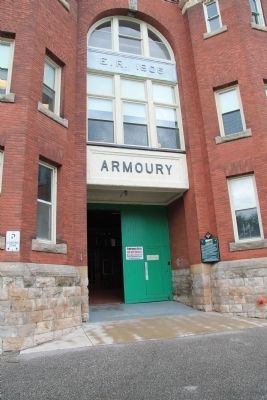
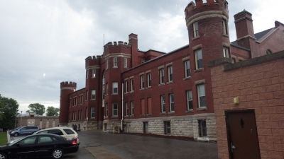
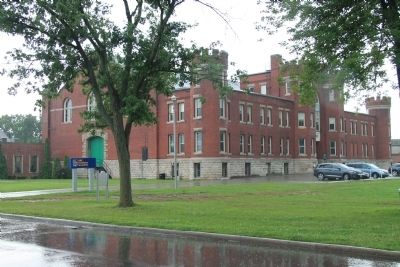
Location. 42° 24.379′ N, 82° 10.962′ W. Marker is in Chatham, Ontario, in Chatham-Kent. Marker can be reached from William Street North just north of Colborne Street (County Route 39), on the left when traveling north. The historical marker is located in Chatham, just southeast of "The Forks" of the Thames River, next to and due south of Tecumseh Park, affixed to the outside wall of the Armoury, just to the right of the parking lot side entrance to the building. Touch for map. Marker is at or near this postal address: 44 William Street North, Chatham ON N7M 5K5, Canada. Touch for directions.
Other nearby markers. At least 8 other markers are within walking distance of this marker. Chatham Blockhouse (about 90 meters away, measured in a direct line); Tecumseh (about 90 meters away); The Forks (about 150 meters away); Skirmish at the Forks (about 150 meters away); British Encampment: Forks of the Thames (about 150 meters away); a different marker also named Skirmish at the Forks (about 150 meters away); Casualties of the Skirmish (about 150 meters away); Kent County Court House (approx. 0.4 kilometers away). Touch for a list and map of all markers in Chatham.
Credits. This page was last revised on February 23, 2024. It was originally submitted on January 20, 2014, by Dale K. Benington of Toledo, Ohio. This page has been viewed 940 times since then and 66 times this year. Photos: 1, 2, 3, 4. submitted on January 20, 2014, by Dale K. Benington of Toledo, Ohio.


