Matthews in Grant County, Indiana — The American Midwest (Great Lakes)
Cumberland Covered Bridge
Inscription.
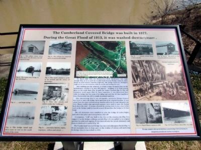
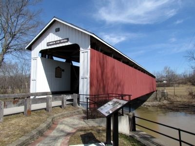
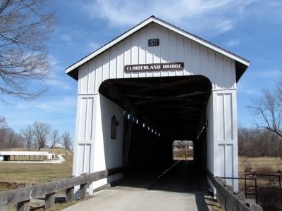
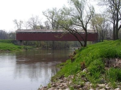
The Cumberland Covered Bridge was built in 1877. During the Great Flood of 1913, it was washed downstream.
On March 26th 1913, the Mississinewa River floodwaters rose high enough (Fig. 2, 3) to push the Cumberland Covered Bridge from its abutments as local citizens watched helplessly. The bridge listed to a 70 degree angle on its way downstream, with the north end leading the way.
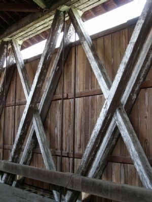
After drifting past the cemetery, it struck a large Sycamore tree on the embankment, causing it to turn 180 degrees - stopping at its final resting place on the south bank (Fig. 4) until the waters receded (Fig. 5). The old abutments stood empty (Fig. 6). Upon inspection, it was discovered that, while the bridge had lost some of its siding and roof, the 181 foot long Howe truss (framework) was still in sound structural condition.
After determining that it was salvageable, contractor George Leamon was hired to move the bridge back upstream to its original location. It was raised from the water and moved on wooden rollers to the road alongside the river. Horses and/or man operated capstans were used to move the bridge back down the road. A woman allowed the moving crew to cut a tree in her yard so the bridge could be turned around (Remember, the bridge is 181 feet long).
The old abutments were modified to raise the bridge 16 inches higher and lock it into place, preventing future slide off.
A temporary "crib" was built in the river at the crossing site (Fig. 7) to support it as the bridge, cribbage and all, (Fig. 8, 9) was pulled to its original position by cable and capstan. It was lowered onto the raised abutments and then re-sided and re-roofed (Fig. 10).
The Cumberland Covered Bridge has survived subsequent floods (Fig. 11, 12 are examples) due, in large part, to the wisdom of raising and anchoring the bridge when it was rebuilt in 1913.
Erected 2011 by Matthews Covered Bridge Historical Society, Inc.
Topics and series. This historical marker is listed in this topic list: Bridges & Viaducts. In addition, it is included in the Covered Bridges series list. A significant historical month for this entry is March 1945.
Location. 40° 23.297′ N, 85° 29.102′ W. Marker is in Matthews, Indiana, in Grant County. Marker can be reached from the intersection of 3rd Street and Front Street, on the right when traveling north. Marker is at southeast end of bridge. Touch for map. Marker is in this post office area: Matthews IN 46957, United States of America. Touch for directions.
Other nearby markers. At least 8 other markers are within 5 miles of this marker, measured as the crow flies. The New Cumberland Gristmill 1853-1920 (here, next to this marker); This Covered Bridge (a few steps from this marker); Matthews Veterans Memorial
(about 800 feet away, measured in a direct line); Lt. Col. Thomas W. (Bill) Boles (about 800 feet away); Covered Bridge (approx. 0.2 miles away); Elizabethtown (approx. 1.8 miles away); The Village of Trask (approx. 3.1 miles away); In Memory Of William J. Leach (approx. 4.7 miles away). Touch for a list and map of all markers in Matthews.
Photographed By Christopher Light, April 25, 2008
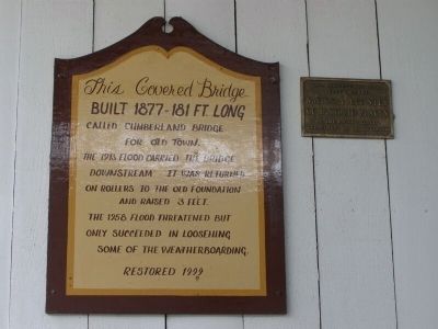
5. Historic Placard on Bridge
This Covered Bridge, Built 1877- 181 Ft. Long, Called Cumberland Bridge for Old Town. The 1913 flood carried the bridge downstream. It was returned on rollers to the old foundation and raised 3 feet. The 1958 flood threatened but only succeeded in loosening some of the weatherboarding. Restored 1999
Photographed By Christopher Light, April 25, 2008
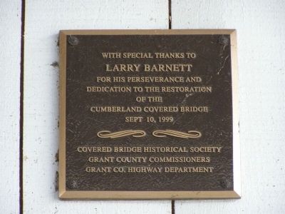
8. Dedication marker
with special thanks to Larry barnett for his perseverance and dedication to the restoration of the Cumberland Covered Bridge, Sept 10, 1999
Covered Bridge Historical Society, Grant County Commissioners, Grand Co. Highway Department
Covered Bridge Historical Society, Grant County Commissioners, Grand Co. Highway Department
Credits. This page was last revised on June 16, 2016. It was originally submitted on January 26, 2014, by Duane Hall of Abilene, Texas. This page has been viewed 713 times since then and 18 times this year. Photos: 1. submitted on March 19, 2013, by Duane Hall of Abilene, Texas. 2, 3. submitted on January 26, 2014, by Duane Hall of Abilene, Texas. 4, 5, 6, 7, 8. submitted on April 30, 2008, by Christopher Light of Valparaiso, Indiana.
