Joaquin Miller Park in Oakland in Alameda County, California — The American West (Pacific Coastal)
Joaquin Millerís Abbey

Photographed By Barry Swackhamer, February 3, 2014
1. Joaquin Millerís Abbey Marker
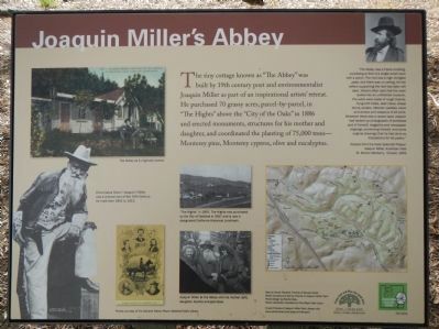
Capitons: The Abbey as it originally looked. (upper-left); Cincinnatus Hiner (“Joaquin”) Miller was a cultural icon of the 19th century. He lived from 1841 to 1913 (lower-left); “The Hights” in 1891. The Hights was purchased by the City of Oakland in 1917 and is now a designated California Historical Landmark. (center, upper); Joaquin Miller at the Abbey with is mother (left), daughter Juanita and grandson. (center, lower); Map by Karen Paulsen, Friends of Sausal Creek (map on right); Photos courtesy of the Oakland History Room, Oakland Public Library.
Below the photograph of Joaquin Miller on the upper-right.
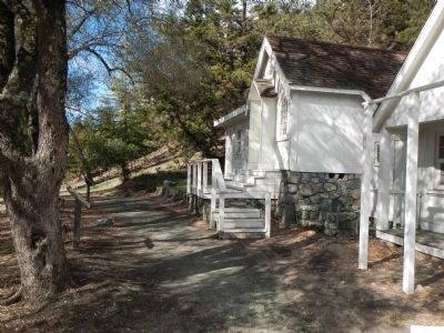
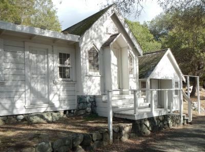
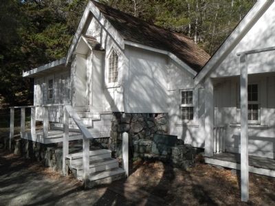
”The Abbey was a frame building consisting at first of a single small room with a porch. The roof was a high shingled peak, and there was no ceiling, for the rafters supporting the roof had been left bare. Visitors often said that the room looked like an unfinished museum. The walls were made of rough boards, hung with hides, bear claws, sheep horns, antlers, Mexican saddles, bows and arrows and weapons of all sort. Wherever there was a vacant spot, Joaquin had tacked up photographs of actresses and of himself, magazine and newspaper clippings concerning himself, and some original drawings that he had done as illustration for his poetry.”
Excerpt from the book Splendid Poseur: Joaquin Miller, American Poet, M. Marion Marberry, Crowell, 1953
Erected 2010 by City of Oakland.
Topics. This historical marker is listed in these topic lists: Arts, Letters, Music • Notable Buildings. A significant historical year for this entry is 1886.
Location. 37° 48.636′ N, 122° 11.583′ W. Marker is in Oakland, California, in Alameda County. It is in Joaquin Miller Park. Marker can be reached from Joaquin Miller Road near Sanborn Road, on the left when traveling east. Touch for map. Marker is at or near this postal address: 3098 Joaquin Miller Road, Oakland CA 94602, United States of America. Touch for directions.
Other nearby markers. At least 8 other markers are within walking distance of this marker. Joaquin Miller (here, next to this marker); A Haven for Artists (a few steps from this marker); The Creation of a Park (within shouting distance of this marker); The Monument Loop: A Legacy (within shouting distance of this marker); The Funeral Pyre (about 700 feet away, measured in a direct line); Pyramid to Moses (approx. 0.2 miles away); John C. Fremont Monument (approx. ľ mile away); Voyage of the Brooklyn (approx. 0.4 miles away). Touch for a list and map of all markers in Oakland.
Credits. This page was last revised on February 7, 2023. It was originally submitted on February 15, 2014, by Barry Swackhamer of Brentwood, California. This page has been viewed 602 times since then and 25 times this year. Photos: 1, 2, 3, 4. submitted on February 15, 2014, by Barry Swackhamer of Brentwood, California. • Syd Whittle was the editor who published this page.


