Josephine in Baldwin County, Alabama — The American South (East South Central)
Josephine
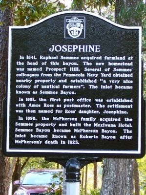
In 1881, the first post office was established with Amos Ross as postmaster. The settlement was then named for Ross’ daughter, Josephine.
In 1898, the McPherson family acquired the Semmes property and built the Mexiwana Hotel. Semmes Bayou became McPherson Bayou. The inlet became known as Roberts Bayou after McPherson’s death in 1925. (Back):
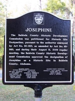
The Baldwin County Historic Development Commission was petitioned for Historic Site Designation, pursuant to authority conveyed by Act No. 80-497, as amended by Act 89-960, and during their August 11, 2009 regular meeting, the Baldwin County Historic Development Commission approved the designation of Josephine as a Historic Site in Baldwin County Alabama.
Erected 2009 by Baldwin County Historic Development Commission.
Topics. This historical marker is listed in this topic list: Settlements & Settlers. A significant historical year for this entry is 1841.
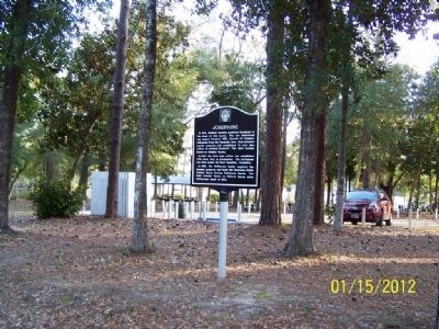
Location. 30° 19.635′ N, 87° 32.121′ W. Marker is in Josephine, Alabama, in Baldwin County. Marker is on Josephine Drive, on the right when traveling east. Located in a small park. Touch for map. Marker is in this post office area: Elberta AL 36530, United States of America. Touch for directions.
Other nearby markers. At least 8 other markers are within 7 miles of this marker, measured as the crow flies. Orange Beach Community Cemetery (approx. 1.9 miles away); Daphne United Methodist Church (approx. 2.8 miles away); Bay Circle (approx. 3.3 miles away); Tampary (approx. 3.3 miles away in Florida); Orange Beach, Alabama (approx. 3.4 miles away); Perdido Pass (approx. 3.7 miles away); Orange Beach Municipal Complex (approx. 4.1 miles away); Romar Beach (approx. 7 miles away).
Credits. This page was last revised on April 8, 2021. It was originally submitted on January 29, 2012, by David J Gaines of Pinson, Alabama. This page has been viewed 1,558 times since then and 79 times this year. Last updated on February 23, 2014, by David J Gaines of Pinson, Alabama. Photos: 1, 2, 3. submitted on January 29, 2012, by David J Gaines of Pinson, Alabama. • Bernard Fisher was the editor who published this page.


