Arcadia in DeSoto County, Florida — The American South (South Atlantic)
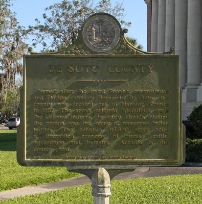
DeSoto County
Erected by Florida Board of Parks and Memorials. (Marker Number F-61.)
Topics. This historical marker is listed in this topic list: Political Subdivisions. A significant historical year for this entry is 1887.
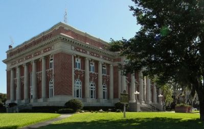
Location. 27° 12.903′ N, 81° 51.515′ W. Marker is in Arcadia, Florida, in DeSoto County. Marker is at the intersection of East Oak Street and Brevard Avenue (U.S. 17), on the left when traveling east on East Oak Street. The marker is located on the front lawn of the DeSoto County Courthouse. Touch for map. Marker is at or near this postal address: 115 East Oak Street, Arcadia FL 34266, United States of America. Touch for directions.
Other nearby markers. At least 8 other markers are within one mile of this marker, measured as the crow flies. DeSoto County War Memorial (a few steps from this marker); DeSoto County Veterans Memorial Flag Pole (a few steps from this marker); DeSoto County World War I Memorial (a few steps from this marker); Arcadia Historic District (about 600 feet away, measured in a direct line); Arcadia City Hall (approx. ¼ mile away); Florida Baptist Orphanage (approx. 0.6 miles away); Arcadia Oak Ridge Cemetery (approx. 1.1 miles away); The British Plot (approx. 1.1 miles away). Touch for a list and map of all markers in Arcadia.
Credits. This page was last revised on July 31, 2017. It was originally submitted on March 23, 2014, by PaulwC3 of Northern, Virginia. This page has been viewed 747 times since then and 21 times this year. Photos: 1, 2. submitted on March 23, 2014, by PaulwC3 of Northern, Virginia.

