Near Independence in Inyo County, California — The American West (Pacific Coastal)
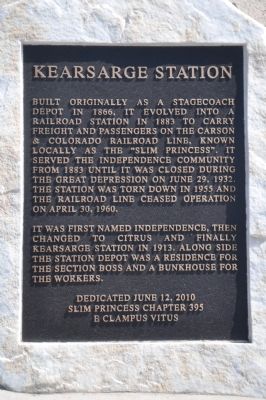
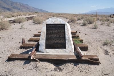
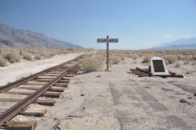
Kearsarge Station
It was first named Independence, then changed to Citrus and finally Kearsarge Station in 1913. Along side the station depot was a residence for the section boss and a bunkhouse for the workers.
Erected 2010 by Slim Princess Chapter No. 395, E Clampus Vitus.
Topics and series. This historical marker is listed in these topic lists: Industry & Commerce • Railroads & Streetcars. In addition, it is included in the E Clampus Vitus series list. A significant historical month for this entry is April 1924.
Location. 36° 48.409′ N, 118° 7.06′ W. Marker is near Independence, California, in Inyo County. Marker is on Citrus Road, on the right when traveling east. Touch for map. Marker is in this post office area: Independence CA 93526, United States of America. Touch for directions.
Other nearby markers. At least 8 other markers are within 5 miles of this marker, measured as the crow flies. Inyo County Courthouse (approx. 4.6 miles away); Putnam’s Stone Cabin (approx. 4.6 miles away); Edwards House (approx. 4.6 miles away); Mary Austin’s Home (approx. 4.7 miles away); Historic Independence (approx. 4.7 miles away); Engine #18 (approx. 4.8 miles away); Hydroelectric Power From Bishop Creek (approx. 4.8 miles away); Mining in Inyo County (approx. 4.8 miles away). Touch for a list and map of all markers in Independence.
Also see . . .
1. Carson & Colorado Railway. (Submitted on April 2, 2014, by Michael Kindig of Elk Grove, California.)
2. Carson & Colorado Railway: Slim Princess Promotional Video. In the early 1880's, the Carson and Colorado Railroad operated narrow gauge steam-powered Baldwin locomotives in Western Nevada and Eastern California. (Submitted on April 2, 2014, by Michael Kindig of Elk Grove, California.)
Credits. This page was last revised on June 16, 2016. It was originally submitted on March 25, 2014, by Michael Kindig of Elk Grove, California. This page has been viewed 752 times since then and 36 times this year. Photos: 1, 2, 3, 4. submitted on March 25, 2014, by Michael Kindig of Elk Grove, California. • Syd Whittle was the editor who published this page.


