Near Sapello in San Miguel County, New Mexico — The American Mountains (Southwest)
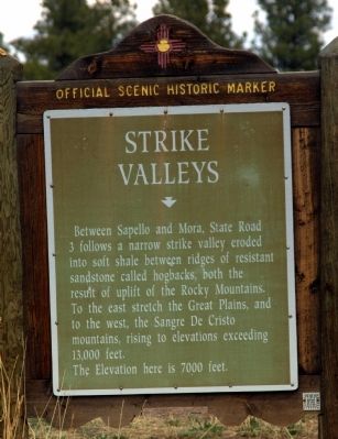
Strike Valleys
The elevation here is 7000 feet.
Topics. This historical marker is listed in this topic list: Notable Places.
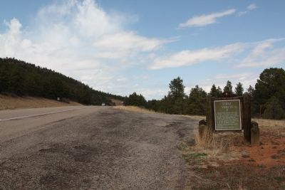
Location. 35° 49.076′ N, 105° 14.308′ W. Marker is near Sapello, New Mexico, in San Miguel County. Marker is on State Road 518 north of State Road 94. Touch for map. Marker is in this post office area: Sapello NM 87745, United States of America. Touch for directions.
Other nearby markers. At least 7 other markers are within 14 miles of this marker, measured as the crow flies. Hermit’s Peak (approx. 5˝ miles away); La Cueva National Historic District (approx. 8˝ miles away); La Cueva Mill (approx. 8.6 miles away); St. Vrain Mill (approx. 12 miles away); Curanderas — Women Who Heal (approx. 12.2 miles away); Fort Union National Monument (approx. 12.3 miles away); Las Vegas (approx. 13.7 miles away).
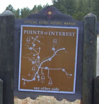
More about this marker. State Road 3 was cut back to Rivera and State Road 518 from Las Vegas north to Taos has replaced it. The “you are here” on the map on the back on this marker (see Photo 3) is not correct. The road where the marker is now located is the north-pointing arrow to the right of the “you are here” mark that points to La Cueva. State Road 518 goes to Mora via La Cueva.

Photographed By J. J. Prats, April 21, 2014
3. Reverse of Strike Valleys Marker
The present alignment of New Mexico Route 518 is not shown on this map. It proceeds in a relatively direct line between its intersection with 94 just south of this marker through La Cueva to Mora. Click on image to zoom in.
Credits. This page was last revised on September 24, 2020. It was originally submitted on April 28, 2014, by J. J. Prats of Powell, Ohio. This page has been viewed 614 times since then and 27 times this year. Photos: 1, 2, 3. submitted on April 28, 2014, by J. J. Prats of Powell, Ohio.
Editor’s want-list for this marker. Photos of a strike valley. • Can you help?

