Marker Logo HMdb.org THE HISTORICAL
MARKER DATABASE
“Bite-Size Bits of Local, National, and Global History”
Bedford in Lawrence County, Indiana — The American Midwest (Great Lakes)
 

Otis Park


Otis Park Marker image. Click for full size.
Photographed By Duane Hall, May 23, 2014
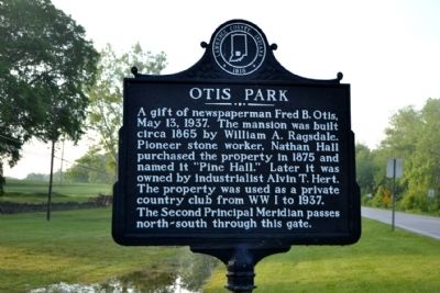
1. Otis Park Marker
Inscription. A gift of newspaperman Fred B. Otis, May 13, 1937. The mansion was built circa 1865 by William A. Ragsdale. Pioneer stone worker, Nathan Hall purchased the property in 1875 and named it "Pine Hall." Later it was owned by industrialist Alvin T. Hert. The property was used as a private country club from WW I to 1937. The Second Principal Meridian passes north–south through this gate.
 
Topics. This historical marker is listed in this topic list: Notable Places. A significant historical month for this entry is May 2007.
 
Location. 38° 51.547′ N, 86° 27.691′ W. Marker is in Bedford, Indiana, in Lawrence County. Marker is on Tunnelton Road, 0.1 miles south of Parkview Drive (16th Street) (U.S. 50), on the left when traveling south. Touch for map. Marker is at or near this postal address: 607 Tunnelton Road, Bedford IN 47421, United States of America. Touch for directions.
 
Other nearby markers. At least 8 other markers are within 2 miles of this marker, measured as the crow flies. Pine Hall (within shouting distance of this marker); a different marker also named Otis Park (within shouting distance of this marker); Bedford Courthouse Square Historic District (approx. 1.1 miles away); Lawrence Park (approx. 1.2 miles away); Lawrence County Bicentennial Celebration (approx. 1.2 miles away); The Cornerstone of Freedom (approx.
Paid Advertisement
Click on the ad for more information.
Please report objectionable advertising to the Editor.
Click or scan to see
this page online
1.2 miles away); Site of the Bedford Branch of the State Bank of Indiana (approx. 1.2 miles away); Lawrence County Vietnam Honor Roll (approx. 1.2 miles away). Touch for a list and map of all markers in Bedford.
 
Additional commentary.
1. National Register
Otis Park and Golf Course was added to the National Register of Historic Places in 2002.
    — Submitted June 2, 2014, by Duane Hall of Abilene, Texas.
 
Otis Park Marker image. Click for full size.
Photographed By Duane Hall, May 23, 2014
2. Otis Park Marker
Otis Park Marker image. Click for full size.
Photographed By Duane Hall, May 23, 2014
3. Otis Park Marker
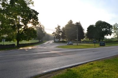
View to north along Tunnelton Road
Otis Park Marker image. Click for full size.
Photographed By Duane Hall, May 23, 2014
4. Otis Park Marker
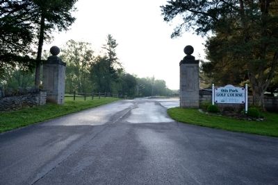
At driveway entrance to Otis Park Golf Course
Otis Park Gate Entrance image. Click for full size.
Photographed By Duane Hall, May 23, 2014
5. Otis Park Gate Entrance
According to the marker, the Second Principal Meridian passes north-south through the gate
Pine Hall image. Click for full size.
Photographed By Duane Hall, May 23, 2014
6. Pine Hall
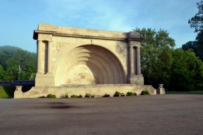
Otis Park Band Shell image. Click for full size.
Photographed By Duane Hall, May 23, 2014
7. Otis Park Band Shell
Erected by the Federal Works Progress Administration in 1938
 
 
Credits. This page was last revised on June 16, 2016. It was originally submitted on June 2, 2014, by Duane Hall of Abilene, Texas. This page has been viewed 538 times since then and 23 times this year. Photos:   1, 2, 3, 4, 5, 6, 7. submitted on June 2, 2014, by Duane Hall of Abilene, Texas.
Share this page.  
Share on Tumblr
m=74152

CeraNet Cloud Computing sponsors the Historical Marker Database.
This website earns income from purchases you make after using our links to Amazon.com. We appreciate your support.
Paid Advertisement
Apr. 26, 2024