Near Croom in Prince George's County, Maryland — The American Northeast (Mid-Atlantic)
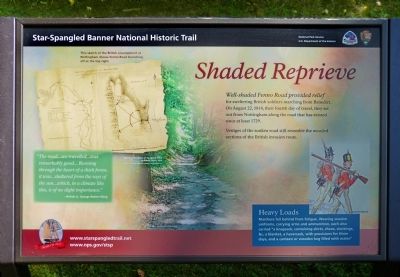
Shaded Reprieve
Star-Spangled Banner Historic Trail
“The road...we travelled...was remarkably good... Running through the heart of a thick forest, it was...sheltered from the rays of the sun...which, in a climate like this, is of no slight" – British Lt. George Robert Gleig
Erected 2014 by National Park Service.
Topics. This historical marker is listed in this topic list: War of 1812. A significant historical year for this entry is 1814.
Location. 38° 43.896′ N, 76° 43.127′ W. Marker is near Croom, Maryland, in Prince George's County. Marker can be reached from Fenno Road. Marker is on the entrance road to Merkle Wildlife Sanctuary. Touch for map. Marker is at or near this postal address: 11711 Fenno Rd, Upper Marlboro MD 20772, United States of America. Touch for directions.
Other nearby markers. At least 8 other markers are within 2 miles of this marker, measured as the crow flies. Merkle Wildlife Sanctuary (approx. 0.6 miles away); Eastern Bluebird (approx. 1.6 miles away); John W. Greene (approx. 1.6 miles away); The Compass Rose (approx. 1.6 miles away); Columbia Air Center (approx. 1.6 miles away); The Cloud Club (approx. 1.6 miles away); The Chesapeake Bay Critical Area Driving Tour (approx. 1.6 miles away); The War of 1812 (approx. 1.6 miles away). Touch for a list and map of all markers in Croom.

Photographed By Allen C. Browne, July 13, 2014
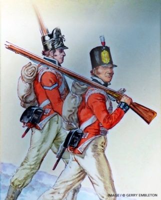
4. Heavy Loads
Marchers fell behind from fatigue. Wearing woolen uniforms, carrying arms and ammunition, each also carried “a knapsack, containing shirts, shoes, stockings, &c, a blanket, a haversack, with provisions for three days, and a canteen or wooden keg filled with water.Close-up of Gerry Embleton painting on marker
Credits. This page was last revised on August 10, 2020. It was originally submitted on July 16, 2014, by Allen C. Browne of Silver Spring, Maryland. This page has been viewed 394 times since then and 20 times this year. Photos: 1, 2, 3, 4, 5. submitted on July 16, 2014, by Allen C. Browne of Silver Spring, Maryland. • Bill Pfingsten was the editor who published this page.


