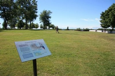
Sackets Harbor in Jefferson County, New York — The American Northeast (Mid-Atlantic)
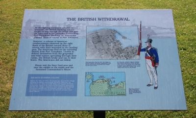
The British Withdrawal
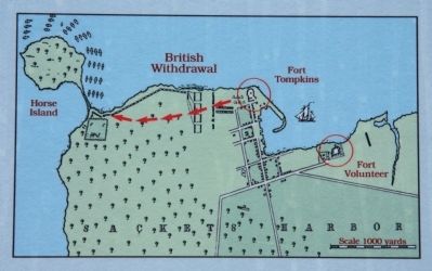
However, a column of American reinforcements observed on the right flank of the British caused them to retreat with their wounded to the landing area. The Americans fired on the retreating British from Fort Tompkins. Unable to defend themselves from the grapeshot and wild rumors spreading through their ranks, the British broke and ran to their boats. The Americans did not follow.
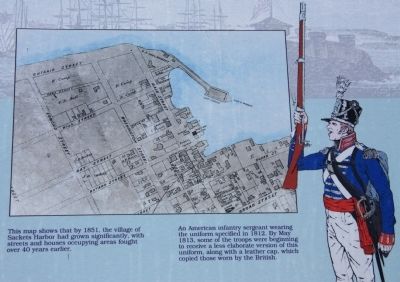
Before the War of 1812, the landscape around the village of Sackets Harbor was heavily forested. However, its trees were cut down to build ships and supply firewood to the navy. Some of the land was developed for agriculture and for the village's expansion west toward Horse Island. A peaceful community of summer cottages now dots the land that once witnessed the British advance from Horse Island.
Erected by the State of New York. (Marker Number 9.)
Topics. This historical marker is listed in this topic list: War of 1812. A significant historical year for this entry is 1812.
Location. 43° 56.976′ N, 76° 7.485′ W. Marker is in Sackets Harbor, New York, in Jefferson County. Marker can be reached from Washington Street east of Ontario Street. This historical marker is located along the walking trail in Sackets Harbor Battlefield State Park, at the northeastern corner of the park. Touch for map. Marker is in this post office area: Sackets Harbor NY 13685, United States of America. Touch for directions.
Other nearby markers. At least 8 other markers are within walking distance of this marker. Fort Tompkins (within shouting distance of this marker); a different marker also named Fort Tompkins (within shouting distance of this marker); 1913 Centennial Monument (about 300 feet away, measured in a direct line); Smoothbore Muzzle Loader Cannon (about 500 feet away); Fight for the Cantonment Area (about 500 feet away); Welcome to Sackets Harbor Battlefield (about 500 feet away); Sackets Harbor War of 1812 Peace Garden (about 500 feet away); American Dragoon Commander Wounded (about 600 feet away). Touch for a list and map of all markers in Sackets Harbor.
Also see . . . Sackets Harbor Battlefield - National Archives. National Register of Historic Places documentation (Submitted on February 25, 2024, by Anton Schwarzmueller of Wilson, New York.)
Credits. This page was last revised on February 25, 2024. It was originally submitted on July 27, 2014, by Dale K. Benington of Toledo, Ohio. This page has been viewed 370 times since then and 25 times this year. Photos: 1, 2, 3, 4, 5. submitted on July 27, 2014, by Dale K. Benington of Toledo, Ohio.
