Remsen in Oneida County, New York — The American Northeast (Mid-Atlantic)
Utica Area
Historic New York
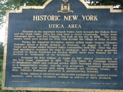
Situated on the important Mohawk Valley route between the Hudson River and the Great Lakes, Utica has long been a travel crossroads. Indian trails converged there, and Fort Schuyler was built on the site in 1758. The community which grew around the fort’s ruins became the village of Utica in 1798.
During the American Revolution, patriot militia under General Nicholas Herkimer halted a British invasion at Oriskany, on August 6, 1777, but Tories and Indians raided Mohawk Valley communities until 1781. After the war land speculators reopened the area to settlement. New York State gratefully granted Baron Friedrich von Steuben 16,000 acres near Remsen for his services as “drillmaster of the Revolution.”
Governor De Witt Clinton at Rome in 1817 started construction of the Erie Canal, completed in 1825. The Erie Canal, its Chenango branch to Binghamton (1836) and railroad service (1837) increased Utica’s importance as a transportation center, and the area prospered. Industrial production started early with textile mills along Sauquoit and Oriskany Creeks. At Ilion, Eliphalet Remington pioneered in manufacturing firearms.
Today, makers of electrical and electronics equipment have replaced textile factories, while fertile farmlands continue as sources of dairy products.
Erected 1963 by New York State Education Department.
Topics and series. This historical marker is listed in these topic lists: Industry & Commerce • Settlements & Settlers • War, US Revolutionary. In addition, it is included in the Historic New York State series list. A significant historical year for this entry is 1758.
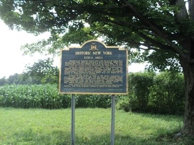
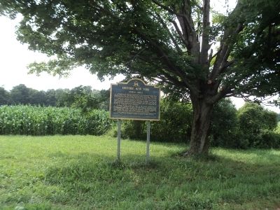
Location. 43° 17.792′ N, 75° 11.118′ W. Marker is in Remsen, New York, in Oneida County. Marker is on New York State Route 12 north of Plank Road, on the right when traveling south. Marker is located in a rest area in the southbound lanes. Touch for map. Marker is in this post office area: Remsen NY 13438, United States of America. Touch for directions.
Other nearby markers. At least 8 other markers are within 4 miles of this marker, measured as the crow flies. Steuben Memorial (about 400 feet away, measured in a direct line); Capt. Simeon Woodruff (approx. 1.8 miles away); Fuller Farm (approx. 2 miles away); Samuel Sizer (approx. 3.1 miles away); Baron Steuben (approx. 3.6 miles away); Steuben State Memorial Park (approx. 3.6 miles away); Jonathan A. Steuben (approx. 3.6 miles away); This Park (approx. 3.7 miles away). Touch for a list and map of all markers in Remsen.
Credits. This page was last revised on June 16, 2016. It was originally submitted on August 3, 2014, by Bill Coughlin of Woodland Park, New Jersey. This page has been viewed 402 times since then and 15 times this year. Photos: 1, 2, 3. submitted on August 3, 2014, by Bill Coughlin of Woodland Park, New Jersey.


