Severna Park in Anne Arundel County, Maryland — The American Northeast (Mid-Atlantic)
Jones Station
The Baltimore & Annapolis Railroad
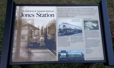
WWII was a lucrative time for the railroad, but following the war automobiles became an attractive travel option and service was replaced by buses after 1950. Service continued on the line only as a diesel powered freight service. During the 1970's, rail operations were truncated to the town of Glen Burnie, a six-mile remnant of the once-vital artery that linked Baltimore and Annapolis. Finally, in 1979, the entire right of way was purchased by Anne Arundel County, marking the end of the line's railroad career.
Prior to the introduction of rail service, the Eastern shore of the Severn River was largely disconnected and inhabited primarily by rural farmers and families. Many of these Marylanders relocated to homes near railroad stations, enabling them to commute to places of work located in distant urban centers.
Residential growth along the new line between Annapolis and Baltimore increased at a rapid rate. New towns and communities emerged from once wooded and pastured lands. To support these new residents, businesses entered the region. The railroad delivered goods to them through its freight service.
[text with picture on left] Jones Station during the B&A electric operation. Notice the existing track beside the trail still stands today.
[text with picture in middle] Officials of the A&B Short Line standing in front of a Jewett electric motor in 1919.
[text with picture on right] Aerial photo of suburban development along the line in 1947.
[text with picture at bottom] Modern photo of a diesel locomotive that once served on the B&A Railroad.
Erected by Anne Arundel County Department of Recreation and Parks.
Topics. This historical marker is listed in this topic list: Railroads & Streetcars. A significant historical year for this entry is 1950.
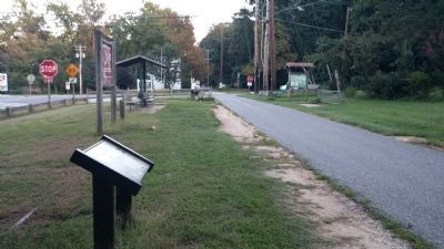
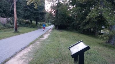
Location. 39° 3.402′ N, 76° 31.765′ W. Marker is in Severna Park, Maryland, in Anne Arundel County. Marker is at the intersection of Baltimore and Annapolis Boulevard (Maryland Route 648) and Jones Station Road, on the right when traveling south on Baltimore and Annapolis Boulevard. Marker is between B&A Blvd and the B&A Trail. Touch for map. Marker is in this post office area: Severna Park MD 21146, United States of America. Touch for directions.
Other nearby markers.
At least 8 other markers are within 5 miles of this marker, measured as the crow flies. Historic Annapolis (approx. ¼ mile away); Lynching in America / Lynching in Anne Arundel County (approx. 1.4 miles away); Frost's Store and Post Office (approx. 3½ miles away); Earleigh Heights Store (approx. 3½ miles away); Iglehart (approx. 3.8 miles away); Belvoir (approx. 3.9 miles away); St. John Neumann, C.Ss.R. (approx. 4.1 miles away); Sawmill (approx. 4.1 miles away). Touch for a list and map of all markers in Severna Park.
Credits. This page was last revised on September 14, 2022. It was originally submitted on September 5, 2014, by F. Robby of Baltimore, Maryland. This page has been viewed 820 times since then and 94 times this year. Photos: 1, 2, 3. submitted on September 5, 2014, by F. Robby of Baltimore, Maryland.


