Halifax in Halifax Region, Nova Scotia — The Atlantic Provinces (North America)
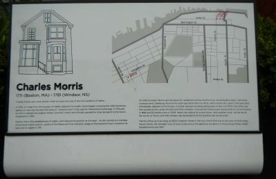
Charles Morris
1711 (Boston, MA) - 1781 (Windsor, NS)
In 1750, on order from the founder of Halifax, Edward Cornwallis, Morris began surveying the entire peninsula, laying out new suburbs and 240 acres of “common land” to be used for firewood and pasturage. A 1762 plan by Morris defined the original Halifax Common, which was officially granted by King George III to the town’s inhabitants in 1763.
Morris’s role in the establishment of Halifax went beyond his position as Surveyor - he also served as a member of the Nova Scotia Council, Justice of the Peace and First Assistant Judge of the Supreme Court, a position he held until his death in 1781.
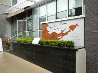
As Chief Surveyor, Morris laid out towns for settlement across the Province, including Barrington, Yarmouth, Liverpool and Lunenburg. Much of his work was done from his office, which stood very near to this spot (and immediately adjacent to his house). A simple Georgian building dating back to the mid 1700s, the office was first located at the corner of Hollis and Morris Streets It moved 30 metres south along Hollis to its 2nd location in 1898 and 50 metres more in 2009. Here it sat waiting for a new home - and another move - as the site at the corner of Morris and Hollis Streets was developed and the building was constructed.
Morris’s office survives today at 2500 Creighton Street in the city’s North End due to the work of the Ecology Action Centre, the Heritage Trust of Nova Scotia and to generous donations of Nova Scotia Power, Dexel Developments and HRM.
Erected 2010 by Heritage Trust of Nova Scotia.
Topics. This historical marker is listed in this topic list: Settlements & Settlers. A significant historical year for this entry is 1750.
Location. 44° 38.512′ N, 63° 34.192′ W. Marker is in Halifax, Nova Scotia, in Halifax Region. Marker is on Hollis Street close to Morris Street, on the left when traveling south. Touch for map. Marker is at or near this postal address: 1277 Hollis Street, Halifax NS B3J, Canada. Touch for directions.
Other nearby markers. At least 8 other markers are within walking distance of this marker. Prince Valiant (about 150 meters away, measured in a direct line); Canadian Corps of Commissionaires (about 210 meters away); Ocean Terminals/le terminal ocean terminals (about 210 meters away); Black-Binney House (about 210 meters away); The Tall Ships Parade 2000 (about 240 meters away); The Grand Dérangement (about 240 meters away); Ships and Men of the Royal Canadian Navy (approx. 0.2 kilometers away); The Volunteers (approx. 0.2 kilometers away). Touch for a list and map of all markers in Halifax.
Also see . . . Charles Morris - Dictionary of Canadian Biogaraphy. Morris’ observations, contained in a 107-page manuscript entitled “A breif survey of Nova Scotia,” led Andrew Hill Clark* to identify him as Nova Scotia’s first practical field geographer. The “survey” contains a “General Discription of Nova Scotia, its Natural Produce, Soil, Air, Winds etca,” identifies three climatic regions, and describes the Indians. (Submitted on October 2, 2014, by Barry Swackhamer of Brentwood, California.)
Credits. This page was last revised on June 16, 2016. It was originally submitted on October 2, 2014, by Barry Swackhamer of Brentwood, California. This page has been viewed 735 times since then and 68 times this year. Photos: 1, 2. submitted on October 2, 2014, by Barry Swackhamer of Brentwood, California. • Andrew Ruppenstein was the editor who published this page.

