Near Griggsville in Pike County, Illinois — The American Midwest (Great Lakes)
Mormontown Site
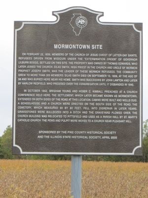
On February 22, 1839, members of The Church of Jesus Christ of Latter-day Saints, refugees driven from Missouri under the “Extermination Order” of Governor Lilburn Boggs, settled on this site. The property was owned by Thomas Edwards, who later joined the church. Silas Smith, high priest in the church and uncle of Mormon Prophet Joseph Smith, was the leader of these Mormon refugees. The community grew to more than 300 members. Silas Smith died on September 13, 1839, at the age of 58 and was buried here near his home. Smith was succeeded by John Lawton and later by Harlow Redfield, who presided over the congregation until it disbanded in 1845.
In October 1842, Brigham Young and Heber C. Kimball preached at a church conference held here. The settlement, which later became known as Mormontown, extended on both sides of the road at this location. Cabins were built and wells dug. A schoolhouse and a church were erected on the south side of the road. The cemetery, which measured 60 by 80 feet, fell into disrepair in later years. Gravestones were bulldozed into a ditch and the graveyard plowed over. The church building was relocated to Pittsfield and used as a parish hall by St. Mary’s Catholic Church. The pews and pulpit were moved to a church near Pleasant Hill.
Erected 2005 by the Pike County Historical Society and the Illinois State Historical Society.
Topics and series. This historical marker is listed in these topic lists: Churches & Religion • Settlements & Settlers. In addition, it is included in the Illinois State Historical Society series list. A significant historical month for this entry is February 1917.
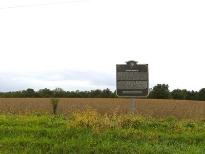
Location. 39° 36.968′ N, 90° 43.812′ W. Marker is near Griggsville, Illinois, in Pike County. Marker is on Illinois Route 106, 0.2 miles west of 427th Street, on the right when traveling west. Touch for map. Marker is in this post office area: Griggsville IL 62340, United States of America. Touch for directions.
Other nearby markers. At least 8 other markers are within 4 miles of this marker, measured as the crow flies. Troutner Dam (approx. 1.2 miles away); Welcome to Lake Pittsfield (approx. 1.3 miles away); East Pike General Store (approx. 2.9 miles away); Colonel William Ross House (approx. 2.9 miles away); Earl C Smith (approx. 3 miles away); Michael J. Noyes House (approx. 3.7 miles away); The Printer's Devil (approx. 3.8 miles away); The Shastid House (approx. 3.9 miles away).
Also see . . . Lost Towns of Illinois - Mormon Town, Illinois. Digital research Library of the Illinois History Journal website entry (Submitted on September 19, 2021, by Larry Gertner of New York, New York.)
Credits. This page was last revised on September 19, 2021. It was originally submitted on November 5, 2014, by Bill Kirchner of Tucson, Arizona. This page has been viewed 928 times since then and 43 times this year. Photos: 1, 2. submitted on November 5, 2014, by Bill Kirchner of Tucson, Arizona. • Andrew Ruppenstein was the editor who published this page.

