St. John's in Avalon Peninsula, Newfoundland, Newfoundland and Labrador — The Atlantic Provinces (North America)
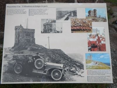
Peacetime Use
Utilisation en temps de paix
Caption, bottom, right (English / French): The Hill is a natural assembly point for civic and national celebrations. In more quiet times its scenery, historic attractions and trails appeal to tens of thousands of visitors annually. / Signal Hill est un lieu de rencontre tour indique pour pique-niques et célébrations. Son panorama, ses hauts-lieux historiques et ses sentiers de randonnée attirent chaque année des dizaines de milliers de visiteurs.
Topics. This historical marker is listed in this topic list: Landmarks.
Location. 47° 34.207′ N, 52° 40.921′ W. Marker is in St. John's, Newfoundland and Labrador, in Avalon Peninsula, Newfoundland. Marker can be reached from Signal Hill Road . Touch for map. Marker is in this post office area: St John's NL A1A, Canada. Touch for directions.
Other nearby markers. At least 8 other markers are within walking distance of this marker. Battle of Signal Hill (a few steps from this marker); Cabot Tower (a few steps from this marker); Noon Day Gun (a few steps from this marker); Fishery (within shouting distance of this marker); 1892: The Great Fire (within shouting distance of this marker); Swiling (within shouting distance of this marker); Ice (within shouting distance of this marker); Transatlantic Radio Signals (within shouting distance of this marker). Touch for a list and map of all markers in St. John's.
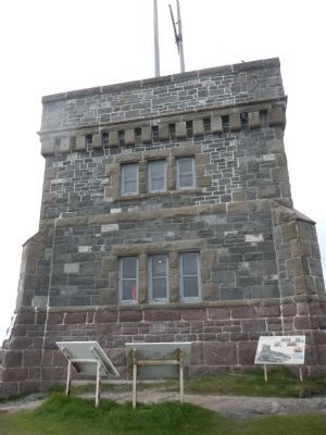
More about this marker. This marker is located at the base of Cabot Tower in Signal Hill National Historic Site.
Also see . . . Signal Hill National Historic Site of Canada, History Parks Canada. Signal Hill has long been used for observation and communication. Here, signalmen surveyed the ocean for ships headed into St. John's harbour, years before the advent of ship-to-shore radio. From signal masts high atop the Hill, flags conveyed information on approaching vessels to military and mercantile interests in St. John's. Merchants then had plenty of time to prepare their docks for incoming vessels. (Submitted on November 20, 2014, by Barry Swackhamer of Brentwood, California.)

Photographed By Barry Swackhamer, June 22, 2014
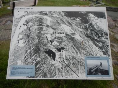
2. Signal Hill: 1941-45
An adjacent panel.
Caption, bottom, left (English / French): Signal Hill, October 10, 1941. 500 American troops were stationed on Signal Hill in World War II. / Signal Hill, le 10 Octobre 1941. Cinq cents soldats américains furent stationnés sur Signal Hill au cours de la Deuxième Guerre mondiale.
Caption, bottom, right (English / French): American Coastal Defence Battery / Batterie de défense côtière américaine.
Credits. This page was last revised on June 16, 2016. It was originally submitted on November 20, 2014, by Barry Swackhamer of Brentwood, California. This page has been viewed 401 times since then and 14 times this year. Photos: 1, 2, 3, 4. submitted on November 20, 2014, by Barry Swackhamer of Brentwood, California. • Andrew Ruppenstein was the editor who published this page.


